GOODS: Downloading Maps
When working in NOAA OR&R's oil spill trajectory model, GNOME, you will first need to obtain a base map of the shoreline. The Web application, GOODS, allows you to more easily use model output or observational data from publicly available external sources.
Through GOODS, you can cut out "on the fly" shorelines from the Global Self-consistent, Hierarchical, High-resolution Shoreline (GSHHS) Database and download them in the GNOME-compatible format. Try it out by choosing "Custom Map Generator" from the main GOODS page.
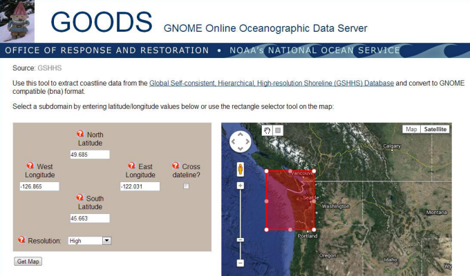
The Custom Map Generator interface in GOODS. A rectangular region can be selected by manually entering bounding latitudes and longitudes, or by using the embedded Google map. Clicking "Get Map" returns a GNOME-formatted base map.
Next, use GOODS to download a wind forecast, or return to the main GOODS page.
Last updated
Thursday, October 31, 2013 5:10pm PDT