OR&R Collaborates with Oregon on Pacific Northwest ERMA Data
The Pacific Northwest Environmental Response Management Application (ERMA) team is pleased to announce a collaboration with Oregon Department of Environmental Quality to identify and update the online mapping tool ERMA with spatial data layers from the Oregon Geospatial Enterprise Office.
The addition of these data layers to Pacific Northwest ERMA provides better coordination and preparedness in the coastal environment for the states of Oregon and Washington. These data layers show a range of information, including geopolitical boundaries, geographic place names, congressional districts, and state parks, as well as data representing Oregon state infrastructure.
In addition, there are numerous layers delineating shorezone classification and exposure and data on coastal access points for use by responders in the event of an environmental disaster.
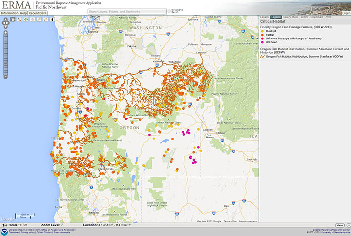
Fish habitat distributions are now available in Pacific Northwest ERMA, along with data on fish passage barriers and hydrology networks, all listed in the ERMA table of contents under National Resource, Habitats, and Managed Areas. OR&R will be continuing to collaborate with regional partners to prepare Pacific Northwest ERMA with an extensive representation of critical data sets to support the mission of response, assessment, and restoration.
For more information, contact Rachel Fox, Nicolas Eckhardt, or Benjamin Shorr.
Go back to OR&R Weekly Report.


