Environmental Sensitivity Index (ESI) Program Holds Briefings for Congressional Staff
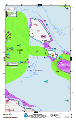
SEPTEMBER 20, 2021 — OR&R staff held three briefings for all interested Congressional staff to introduce them to Environmental Sensitivity Index (ESI) maps and data, and explain their current status in different regions of the country. The presentations were led by Scott Lundgren, Director of NOAA OR&R, and Nicolle Rutherford, ESI Program Manager.

The briefings were divided by region, with the Great Lakes regional briefing on September 8th, a briefing for Alaska, Hawaii, and the Pacific Territories on September 9th, and a briefing for the Gulf of Mexico on September 15th. There was strong attendance at each briefing from the staff of relevant members and committees.
The briefings served as a great opportunity for OR&R to share the critical role of ESIs in disaster response, preparation, and natural resource damage assessment, while also shining a light on the importance of securing further resources so that the maps may be refreshed on a regular basis.
The series of briefings will continue in October with sessions focused on the Northeast Atlantic, Southeast Atlantic, and the Pacific Coast.
For more information, please contact Scott.Lundgren@noaa.gov and Nicolle.R.Rutherford@noaa.gov.

