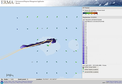
Applications for Mapping Spilled Oil in Arctic Waters
SEPTEMBER 25, 2015--Earlier this month the OR&R Spatial Data Branch supported researchers from the University of Alaska Fairbanks and Rutgers University for the second year during a U.S. Department of Interior Bureau of Safety and Environmental Enforcement (BSEE) and the Bureau of Ocean Energy Management (BOEM) funded Arctic Tracer Release Experiment (ARCTREX) to simulate a small oil spill in the Chukchi Sea.
Rhodamine dye injections and satellite-tracked surface drifters were monitored over time in the Arctic Environmental Response Management Application (ERMA). The experiment produced valuable information on ocean surface properties and dispersion at various spatial and temporal scales. Results of this experiment will also be compared with two-dimensional High Frequency Radar surface current measurements. Expanding on lessons learned in 2014, the Spatial Data Branch was able to automate and streamline data ingestion and visualization to near-real time by leveraging the ERMA Application Program Interface.
For more details, please contact Amy.Merten@noaa.gov.
Go back to OR&R Weekly Report.

