Deepwater Horizon Long-Term Data Management Coordination
JUNE 23, 2017--OR&R and NOAA’s National Marine Fisheries Service/Habitat Conservation partnered with NOAA National Environmental Satellite, Data, and Information Service/National Centers for Environmental Information (NCEI) to sponsor a workshop.
Deepwater Horizon (DWH) Long-Term Data Management Coordination was held on June 7- 8 at NOAA’s Gulf of Mexico Disaster Response Center in Mobile, AL.
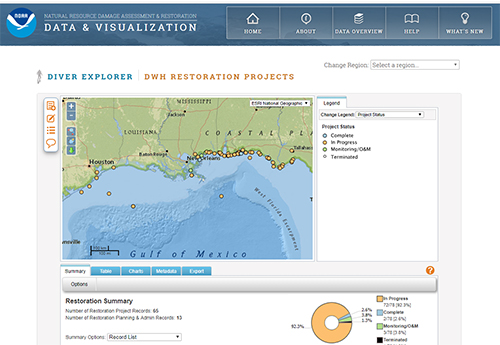
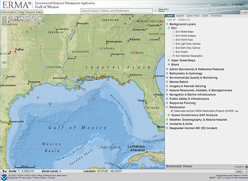
The workshop was facilitated by the Coastal Response Research Center. Through the DWH Natural Resource Damage Assessment and subsequent close-out process, OR&R developed a data warehouse (DIVER) and visualization system (Gulf of Mexico ERMA) that is being coupled with NCEI’s archival process and will be used as a long-term repository for accessing/archiving NRDA injury assessment data. These data management and visualization applications form the foundation for managing the restoration project planning and monitoring data, and making the data publicly available for the next 10 – 15 years. The main impetus for this workshop was to facilitate public access to data collected and managed by outside partners by developing linkages to or data exchanges among Gulf of Mexico data management systems. Participants included data generators, data managers, and data users from federal, state, academic and NGO communities with responsibilities for Gulf of Mexico restoration.
We discussed methods for fostering collaboration among the Gulf of Mexico Research Initiative Information and Data Cooperative, the National Academies of Science, the RESTORE Council, the Gulf of Mexico Alliance, the Centers of Excellence through the RESTORE Act, the Gulf of Mexico Coastal Ocean Observing System, the Ocean Conservancy, and the Louisiana Coastal Information Management System. We identified standards, protocols and guidance for long term data management being used by these partners for DWH NRDA, restoration, and public health efforts. We will work to define best practices for data discovery and data exchange, among systems, discoverability, accessibility, synthesis, usability and metadata standards through ongoing workgroups.
Deepwater Horizon Restoration Projects from DIVER are shown here with marine mammal data from the Ocean Conservancy Gap Analysis. The GAP analysis is an inventory of nearly 700 past and existing long-term monitoring efforts in the Gulf and is an example of where ERMA is being utilized to facilitate data exchanges among Gulf partners.
Click to access data in DIVER or ERMA.
For more information, contact Amy.Merten@noaa.gov.
Go back to OR&R Weekly Report.


