Remote Sensing of Oil Emulsion Project
JULY 29, 2016—The Bureau of Safety and Environmental Enforcement (BSEE) and NOAA completed Phase One of the Deepwater Horizon Lessons Learned Studies: Detection of Oil Thickness and Emulsion Mixtures using Remote Sensing Platforms project.
The testing took place at the Ohmsett (Oil and Hazardous Materials Simulated Environmental Test Tank) facility in Leonardo, New Jersey.
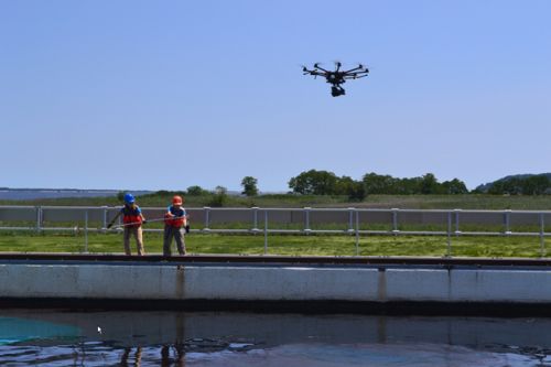
This first phase of work involved the coordination of simultaneous capture of satellite, fixed wing and rotary aircraft as well as unmanned aerial vehicle data from a variety of remote sensors. A Brazilian company, Fototerra, flew a large custom turbo prop with multiple sensors, Ocean Imaging flew a contract helicopter at three separate altitudes with their portable Tactical Response Airborne Classification System (TRACS) system, and WaterMapping flew a UAS octocopter equipped with a high resolution true color and near-infrared thermal cameras providing a wide array of sensor data collected within 15 minutes of the satellite overpass. This synoptic sampling took place on 4 individual days during the week of July 18.
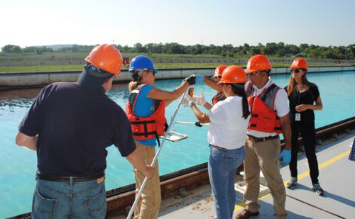
The OR&R team also performed in situ sampling of oil and water chemistry as well as oil thickness measurements in conjunction with the sensor data allowing the comparison of the remote sensing systems for utility in response and assessment activities. These in situ sampling methods were extensively tested and modified to meet the practical limitations of ship-based sampling and the Ohmsett environment provided an invaluable opportunity to improve traditional methods and improve the potential success in future activities. These sampling methods will be used at the Taylor Energy site in the Gulf of Mexico later this year.
A technical demonstration and a series of short presentations were provided to visitors including Office of Response and Restoration Director, Dave Westerholm and OR&R Assessment and Restoration Division Chief, Tony Penn, as well as a variety of NOAA, BSEE, EPA and USCG staff.
See the BSEE press release.
For more information, contact George.Graettinger@noaa.gov.
Go back to OR&R Weekly Report.


