Back to top
1 of 17
River scene with trees.
Assessing and Restoring our Shores

The Office of Response and Restoration's Assessment and Restoration Division (ARD) is responsible for evaluating and restoring coastal and estuarine habitats damaged by hazardous waste releases, oil spills, and vessel groundings. Working with partners, ARD, through NOAA's Damage Assessment, Remediation, and Restoration Program, determines the harm to the environment and defines the amount of restoration required to compensate the American public for those impacts.

Water with boom and boats in background
2016 Accomplishments: The Year in Review

NOAA's Office of Response and Restoration works to minimize environmental damages and prepare coastal communities to better deal with the impacts of marine debris, oil spills, and hazardous materials.

Our accomplishments in fiscal year 2016 shows our dedication to science-based solutions for protecting and restoring natural resources from coastal hazards.

  • 178. That's the number of oil spills, chemical releases, and other threats we responded to.
  • 28. That's the number of training and response events hosted at the Gulf of Mexico Disaster Response Center.
  • $1,807,787. That's the amount awarded for marine debris prevention and removal projects.
  • 2054 That's the number of people we trained in oil and chemical spill response and planning.
  • $67,843,894. That's the amount of dollars for restoration recovered from responsible parties from settlements at two oil spills and one waste site.

<?php drupal_add_css("sites/all/themes/orr/css/front-page-accomplishments-report-2016.css"); ?>

Debris, rope, on a beach with ocean in background.
Reducing Marine Debris on our Shores

The NOAA Marine Debris Program, a division of the Office of Response and Restoration, leads national efforts to research, prevent, and reduce the impacts of marine debris. Staff are positioned across the country and support marine debris projects in partnership with state and local agencies, tribes, non-governmental organizations, academia, and industry. The program also spearheads national research efforts and works to change behavior in the public through education and outreach initiatives.

Seascape with light on the horizon
Gulf of Mexico Disaster Response Center

NOAA's Gulf of Mexico Disaster Response Center (DRC) brings together NOAA-wide resources to improve preparedness, planning, and response capacity for natural and man-made disasters along the Gulf Coast. Located in Mobile, Alabama, the center is focused on the five states bordering the Gulf of Mexico. The facility is designed to survive up to Category 5 hurricane winds, contains a Force-5 tornado shelter, and has backup power systems to continue operations in the midst of severe weather. Intended to serve as a safe and ready command center during major disaster responses in the Gulf, the DRC also offers facilities for drills, training, workshops, and planning activities.

Aerial view of oil slick on water.
Responding to Oil and Chemical Spills

The Office of Response and Restoration's Emergency Response Division (ERD) supports the U.S. Coast Guard by providing round-the-clock scientific expertise for oil and chemical spills in United States marine and coastal waters. ERD's efforts facilitate spill prevention, preparedness, response, and restoration through its network of Scientific Support Coordinators; a Seattle-based support team of scientists, technical experts, and software developers; and federal, state, and academic partners.

Red-armed hydraulic shovel scarping soil near water's edge.
Final BP Settlement on Deepwater Horizon

OR&R’s Assessment and Restoration Division worked with the Restoration Center and the Office of the General Counsel Natural Resources Section and multiple trustee agencies to produce the Programmatic Damage Assessment and Restoration Plan/Programmatic Environmental Impact Statement (PDARP/PEIS) for the Deepwater Horizon oil spill. The 1,400+ page report was the basis for the record settlement of $8.8 billion for the restoration of injured natural resources between the natural resource trustees and BP.

Sinking ship in waterway.
Florida Incident Waterway Debris Response Guide

The NOAA Marine Debris Program completed the Florida Incident Waterway Debris Response Guide in 2016 to improve preparedness for response to and recovery from events like severe storms, floods, tsunamis, or maritime disasters that can result in a large influx of marine debris. This guide is the second completed in an ongoing effort by the NOAA Marine Debris Program to collaborate with local, state, and federal entities in coastal states in developing state-specific guidance documents for easy reference in the case of a severe marine debris event. The Florida Guide serves as a comprehensive reference for incident waterway debris response. It contains an outline of existing response structures and captures all relevant responsibilities and existing procedures in Florida. The guide is accompanied by a Field Reference Guide with pertinent quick reference information for in the field emergency response operations.

Beach with waves and clouds in sky.
Science of Oil Spills and Chemical Releases Training

In 2016, OR&R’s Emergency Response Division (ERD) and NOAA’s Disaster Response Center launched the Science of Chemical Releases (SOCR) class. Over 30 SOCR students learned critical chemical hazard information and received hands-on training in the use of chemical response and planning software tools, including CAMEO Chemicals, ALOHA, and MARPLOT.

Shoreline Cleanup and Assessment Technique taught 275 responders this critical program that drives operational decisions and deployment of assets during a spill response. In addition, ERD reached 495 responders through the online training, created in partnership with The COMET® Program, covering aerial observation of oil on water.

Other countries expanded on the training to the Panama Canal Authority under the auspices of the Memorandum of Agreement between the Panama Canal Authority and the U.S. National Response Team on the use of NOAA software tools for chemical response (CAMEO) and oil spill transport and fate (GNOME, ADIOS). Responders and planners in Panama, El Salvador, Costa Rica, Belize, Honduras, Nicaragua, and Guatemala now have information and tools to better manage and plan for responses to oil and chemical incidents.

NOAA’s Response Asset Directory

NOAA’s Gulf of Mexico Disaster Response Center (DRC) - housed in the Office of Response and Restoration - takes a leadership role in building NOAA’s preparedness and ability to respond to, and mitigate, environmental impacts from natural and human-caused disasters such as hurricanes and major oils spills. As part of the National Ocean Service Roadmap resilience and response strategies, an online NOAA Response Asset Directory (NRAD) was developed. The NRAD is an all-hazards resource directory that includes searchable and spatial information on physical resources, as well as NOAA services which could be used or in need of protection during response and recovery from disasters.

The pilot project has been completed for six states at high risk for hurricane threats - Texas, Louisiana, Mississippi, Alabama, Florida, and Georgia. Initial responses highlight the application as a very powerful planning, response, and incident recovery tool, and the expectation is that the directory will expand nationally over the next year. With the implementation of the NRAD, NOAA will be better positioned to respond to future disasters efficiently through improved shared knowledge and access to available resources for all NOAA staff.

Scuba diver near coral reef.
Regional Preparedness Trainings

From flooding events to oil spills, NOAA works to ensure that local, state, and federal responders are prepared and understand threats, potential consequences, agency authorities and responsibilities, and available products and services aids in planning, mitigation, response, and recovery efforts. NOAA’s Gulf of Mexico Disaster Response Center, part of the Office of Response and Restoration, developed and provided three stakeholder-focused NOAA Regional Preparedness Trainings (NRPTs) across the Gulf to address specific response issues and enhance regional preparedness within NOAA and partnership agencies and groups.

The first NRPT, in Galveston, Texas, focused on improving response for oil spills impacting the Flower Garden Banks National Marine Sanctuary. The course examined response options such as dispersants and in situ burning in highly sensitive protected areas. The NRPT in Mobile, Alabama, focused on understanding affected stakeholders and threats from a natural disaster and concurrent spill on commerce and the environment in the Port of Mobile and adjacent sensitive habitats. The third NRPT, St. Petersburg, Florida focused on improving responders’ knowledge and abilities to communicate information regarding controversial and alarming publicly sensitive topics - such as dispersant use, seafood safety, fisheries impacts, and public health concerns - to the public.

Boat on water near oil spill.
New Integrated Spill Models and Tools

NOAA Office of Response and Restoration (OR&R)’s Emergency Response Division (ERD) has been driving a multi-year effort to improve GNOME, the flagship trajectory modeling tool for NOAA’s spill response support. The new version will provide a web interface and powerful features including integration with the NOAA ADIOS oil weathering model, web interface for prepackaged tide and current information for a particular place, a new deepwater blowout model, improved 3D support, and enhanced output to better interact with GIS systems. With increasing oil development and shipping in the Arctic, the new model will more accurately predict the weathering and transport of oil as it occurs in cold-water environments and in the presence of ice.

An additional benefit to responders and planners will be the integration of the Response Options Calculator (ROC) into GNOME. ROC is a multi-faceted tool that assesses the general performance of oil spill response systems, such as the mechanical recovery of oil from the water, the application of dispersant, and the burning of spilled oil. When complete in early 2017, the new GNOME will be used by OR&R to provide timely information for decision-making during oil spill response - and will be freely available to the broader academic, response, and oil spill planning communities.

Trash on the sand.
NOAA Marine Debris Program’s 10 Year Anniversary

The NOAA Marine Debris Program marked ten years of combating marine debris in 2016. The program has accomplished much during this time, including activities ranging from supporting over 100 marine debris removal projects which have removed over 5,500 tons of debris, funding over 30 prevention projects and numerous research projects, and creating powerful education and outreach materials including curricula, displays, and award-winning outreach tools to help raise awareness about and prevent more marine debris. In this time period, the program has expanded nationwide to include ten regions, responded to four severe marine debris events, and has led the development of severe marine debris response plans and action plans across the country. The NOAA Marine Debris Program is proud of what it has accomplished over the last ten years and will continue to work towards the vision of a global ocean and its coasts free from the impacts of marine debris in the years to come.

Man crouched in rocky shallow water with water grasses.
Release of National Data Management Tool

OR&R released the newly developed Data Integration, Visualization, Exploration and Reporting tool (DIVER) Portal, which builds upon the environmental data warehouse and query tools that were initially developed to support the Natural Resource Damage Assessment (NRDA) and Restoration for the Deepwater Horizon Oil Spill. DIVER served as the official data management and repository for the NRDA case, which was settled in a consent decree with the Department of Justice. The new DIVER Portal provides a secure collaboration and data management space for integrating and managing restoration monitoring data collected as part of the NRDA settlement, and serves as a Gulf of Mexico-wide data management and data distribution tool. The new DIVER Portal also expands coverage to the entire coastal and Great Lakes environment and data types now include environmental data such as samples, observations, photos and oceanographic data in addition to activity and project information. The DIVER Portal can be used for data collection, data management and data querying for environmental disasters and for planning and preparedness exercises and drills.

Person in diving suit on a boat with two others.
Response Highlights in Fiscal Year 2016

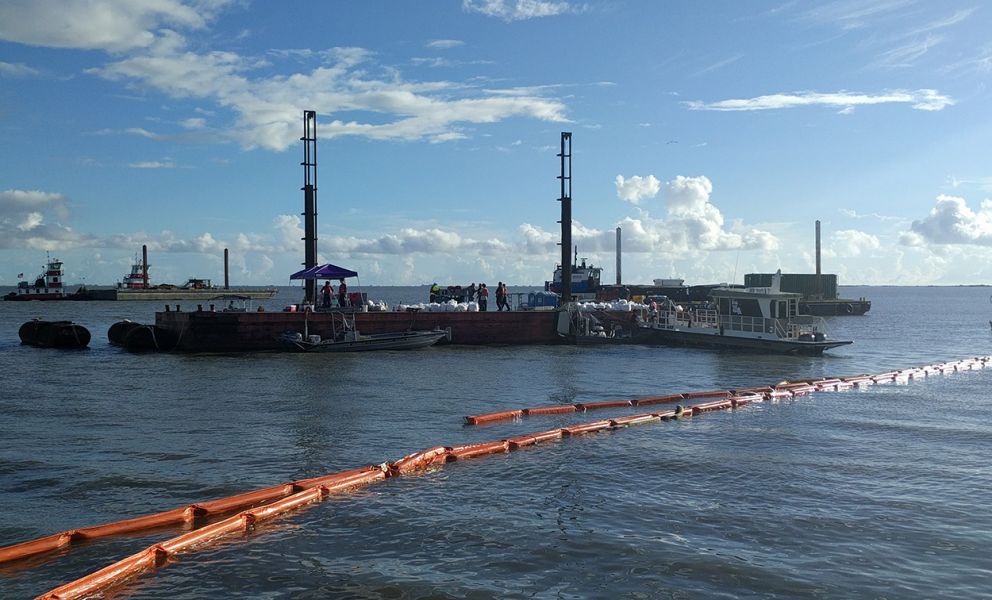
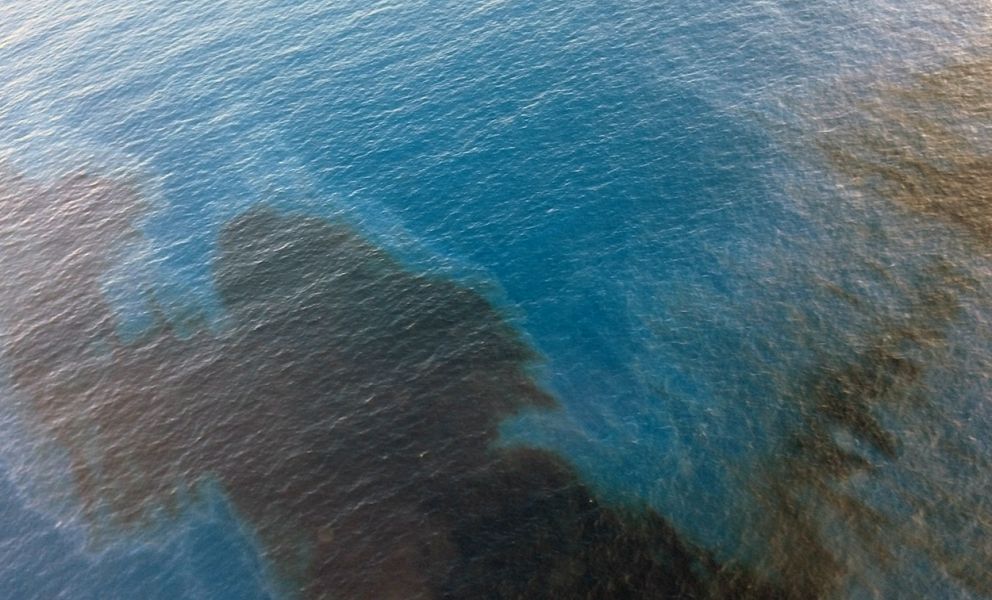
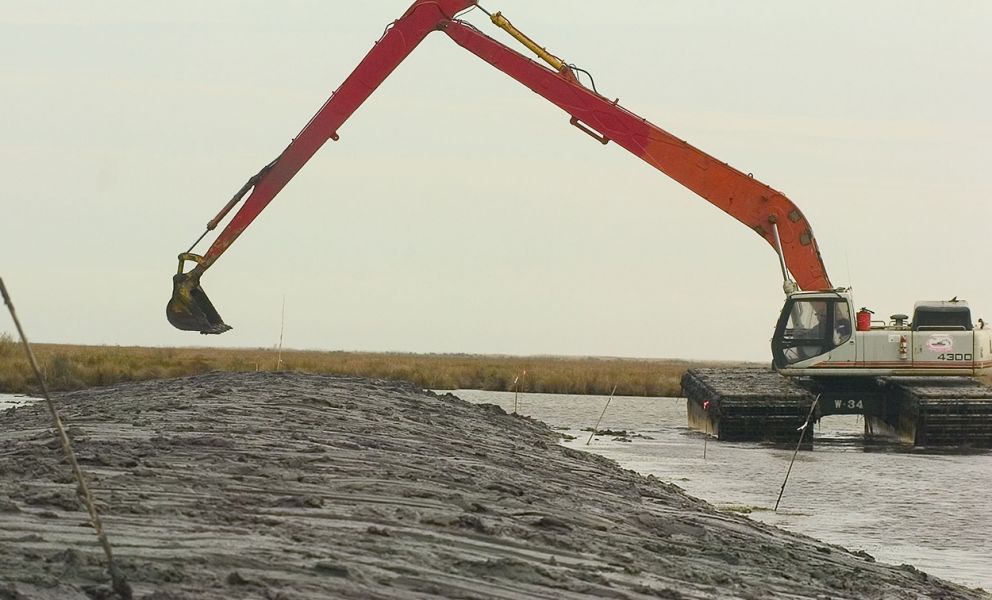
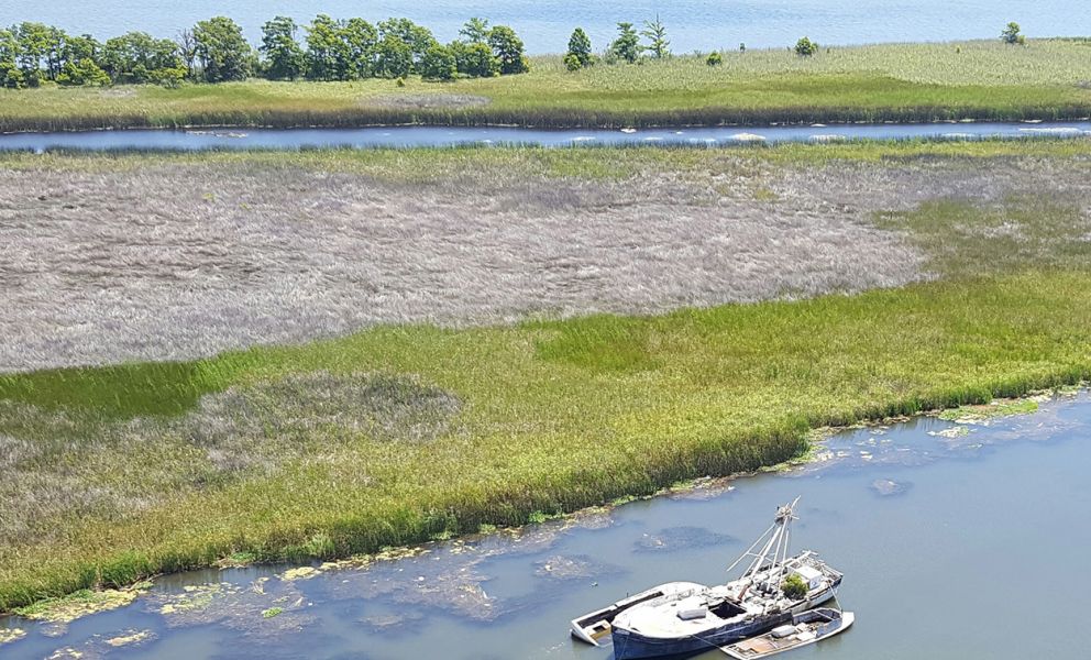
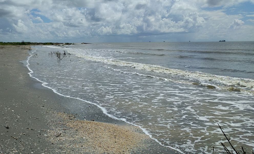
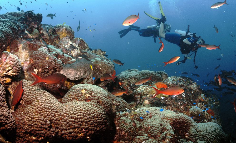
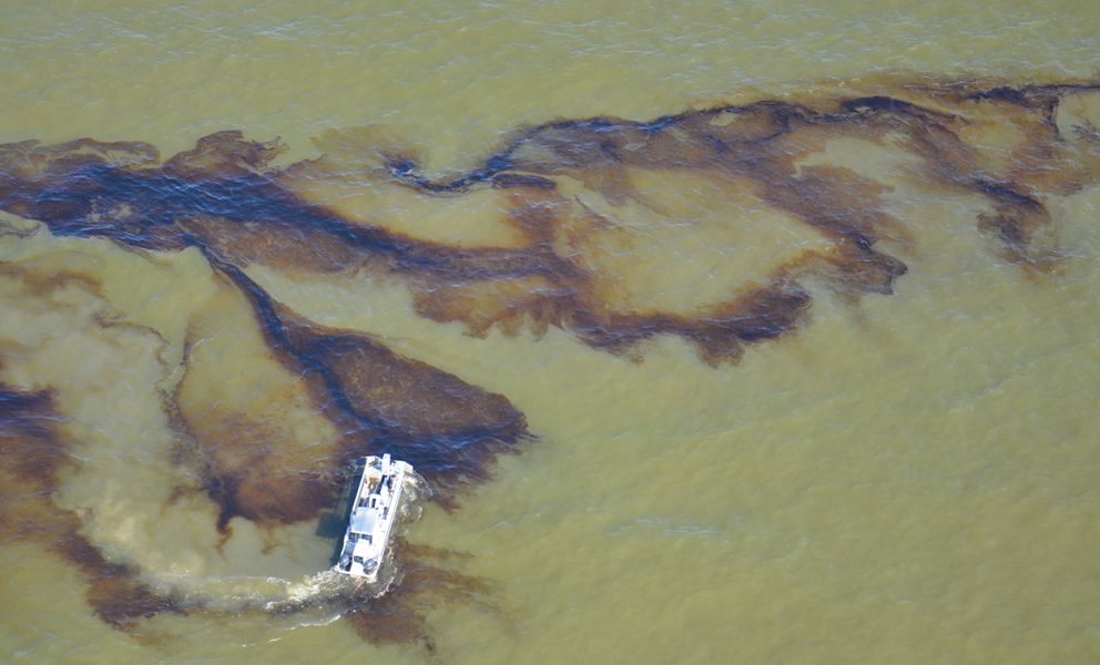
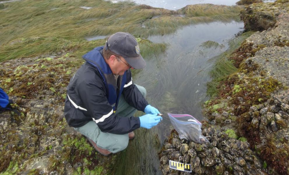
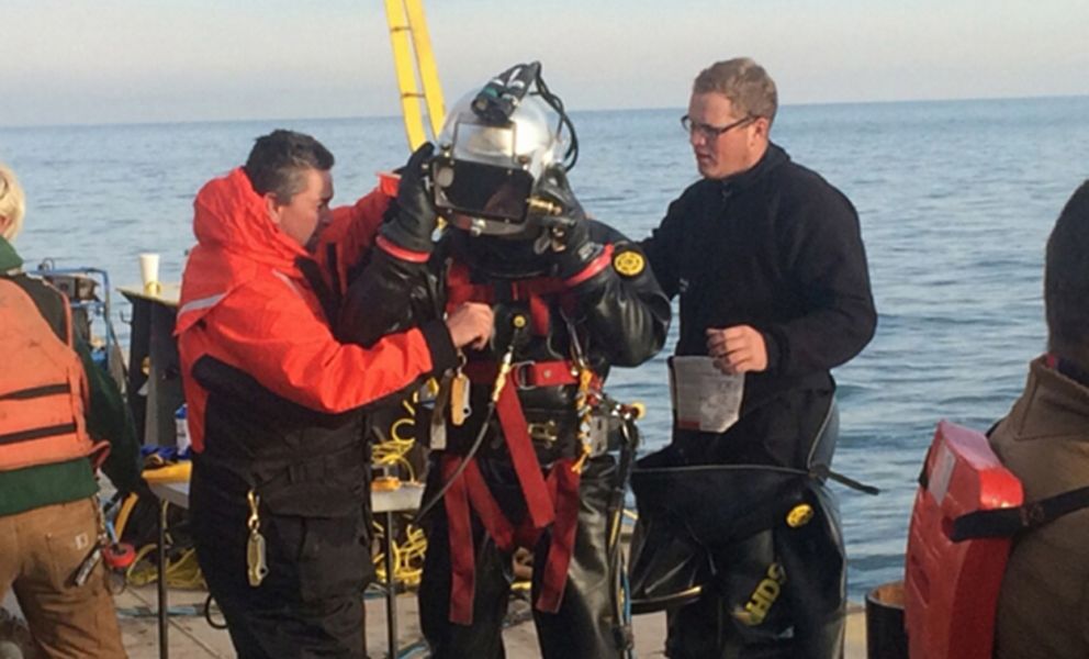
The US Coast Guard (USCG) conducted an assessment dive of the the sunken wreck of Tank Barge Argo, lost in 1937 in Lake Erie, when an active chemical plume and odors were noted above the tank barge. The benzene cargo was characterized and ultimately removed. NOAA Office of Response and Restoration’s Emergency Response Division (ERD), with state and federal partners, managed the development of environmental monitoring, water sampling, sediment sampling, and waste disposal plans for the Argo response. Two tug boats collided on the Mississippi River near Columbus, Kentucky, spilling an estimated 120,500 gallons of oil. The oil was heavier than water and was at the bottom of a murky, flowing river; posing unique challenges. ERD provided river flow forecasts, chemistry of the spilled oil, a submerged oil assessment, assistance with a side scan sonar, and assistance with the selection of unique response technologies, such as environmental clamshell dredging. ERD supported the USCG response to an oil spill in the Green Canyon oil reserve area in the Gulf of Mexico, providing oil spill trajectory analysis and information on natural resources potentially at risk from the oil, including species and habitats in the Flower Garden Banks National Marine Sanctuary.

People working on grassy shoreline near boats in water.
Settlements in Michigan, Washington, and Maine

Two settlements with the company responsible for the 2010 Kalamazoo River oil spill, the State of Michigan and NOAA's Damage Assessment Remediation and Restoration program secured over $62 million to restore the environment impacted by the spill. NOAA’s scientific support helped the state secure $58 million for restoration. NOAA and federal and tribal partners secured an additional $4 million. The spill resulted in about 843,000 gallons of a heavy form of crude oil known as “tar sands oil,” into a tributary of the Kalamazoo River. Projects to restore the harm include restoring and protecting hundreds of acres of wetlands and upland habitat, replacing culverts to enhance river flow, and increasing recreational opportunities for the public along the Kalamazoo River.

In Washington State a settlement worth about $5 million continued restoration of Commencement Bay, which was impacted by the pollution from industrial activity. NOAA and partners have generated over $70 million dollars over the last 20 years to hold polluters accountable and reestablish the bay.

In Maine, a $880,000 settlement was reached for an oil spill at the Gulf-Chevron marine oil terminal. The settlement will support restoration projects for natural resources, including aquatic habitats and areas of recreational use.

Person pointing at trash on sand.
The Citizen Science Marine Debris Monitoring Toolbox

In 2016, the NOAA Marine Debris Program launched the “Get Started Toolbox” for the Marine Debris Monitoring and Assessment Project (MDMAP), the Marine Debris Program’s flagship citizen science initiative which engages partner organizations and volunteers across the nation to survey and record the amount and types of marine debris on shorelines. The Get Started Toolbox serves as a resource for current and new project participants and includes a tutorial series that covers the basics of the MDMAP, a collection of protocol documents and user guides, data analysis tools, a searchable photo gallery of marine debris items, answers to frequently asked questions, and even a quiz to test your marine debris monitoring knowledge. These resources aid participants in continuing their MDMAP monitoring efforts, which include over 188 regularly-surveyed sites throughout the country. The data collected through this program provides baseline data that can be used to guide marine debris policy development, education and outreach, and addresses important research questions.

People sitting at desks in classroom.
Incident Command System 300 Course

In 2016 NOAA’s Disaster Response Center (DRC), in coordination with internal and external partners, continued to fill preparedness gaps by developing the NOAA Incident Command System (ICS) 300: Intermediate ICS for Expanding Incidents. ICS is a standardized approach to effectively manage disaster situations and has been adopted at all levels of government—local, state, and federal. ICS creates a standardized system that is intuitive and easy to follow, but also allows for flexibility since each situation is different. The DRC developed an ICS 300 course specific to NOAA’s needs to support internal management of emergencies, as well train NOAA staff who are deployed in support of the Federal Emergency Management Agency, the US Coast Guard, and other federal agencies during disasters. The NOAA ICS 300 course meets the requirements of the standardized ICS 300 curriculum, but also includes information on regulatory authorities, NOAA’s roles during emergency response, NOAA’s Concept of Operations Plan, and other key aspects of disaster response that are unique to NOAA’s preparedness and response.

The pilot class for this new course was held in Silver Spring, Maryland, and the DRC plans to offer this course multiple times throughout each fiscal year to build knowledge and a broader response capacity with NOAA.

previous next