Exploring the Future of Aerial Imagery Services at Oil Spills in California
MARCH 27, 2015 -- OR&R Assessment and Restoration Division staff organized a meeting with Coast Guard, California spill responders, and a San Francisco-based software start-up company at Coast Guard Station San Francisco on March 17, 2015.
The group met to review a demonstration of a new aerial imagery data capture and analysis service and discuss potential applications for spill response and damage assessment.
The aerial imagery service, Airphrame, has developed software allowing fast ordering, programming, and deployment of their small unmanned aircraft system (UAS) over suitable land and water locations where response and restoration personnel may have use for high-resolution still imagery.
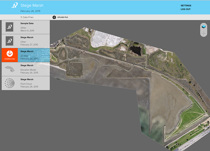
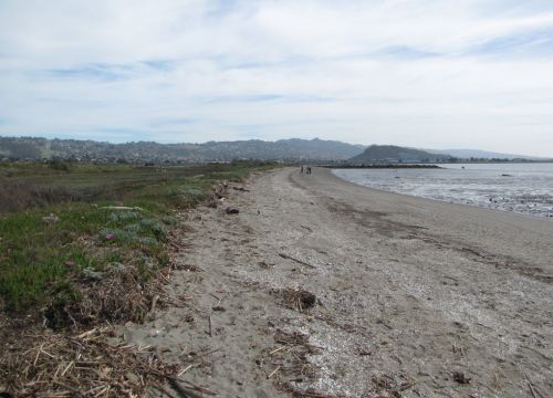
In February OR&R ordered a demonstration flight over a one-square-kilometer portion of marsh and beach along the East Bay shoreline of San Francisco Bay.
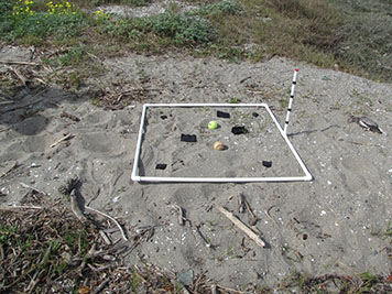
Representatives from NOAA and State of California observed the remote-controlled photography after placing various objects on the site to assess the capabilities of the product.
The imagery, which was rectified (corrected) to match the actual land and water surfaces and allow precise measurements between features, was produced at a cost of $625.
Airphrame operates in the cloud (the virtual cloud, not the atmospheric). Orders are placed on their website by zooming in on a Google Earth map and creating a polygon where the imagery is needed. The UAS is programmed and flies a pre-determined pattern, and can convey thumbnails while capturing the images. Final products are uploaded to a secure website where users may view and download. OR&R brought the final product into Southwest ERMA, where it can be viewed.

Airphrame is exploring additional demonstrations which would detect floating oil from natural seeps in Santa Barbara County and count beach users. Despite several limitations, such newly emerging imagery capture services might be a means to produce relatively low-cost, useful response and assessment products in the future. The OR&R staff responsible for this demonstration and meeting was Jordan Stout, Laurie Sullivan, Matt Dorsey, Rob Ricker, and Greg Baker.
This test is just one of OR&R's evaluations of UAS applications in recent months; Michele Jacobi is coordinating OR&R UAS evaluations with broader efforts across multiple NOAA offices where they are being evaluated for a wide variety of needs.
For more information, contact Greg Baker.
Go back to OR&R Weekly Report.


