Field Demo of Oil Spill Monitoring Robot
OCTOBER 5, 2018 — Researchers at the Monterey Bay Aquarium Research Institute (MBARI), Woods Hole Oceanographic Institution (WHOI), and University of Alaska’s Arctic Domain Awareness Center (ADAC) are developing a small Long-Range Autonomous Underwater Vehicle system (Tethys LRAUV) to detect oil spills in some of the most challenging oceanic environments on the planet, under arctic sea ice.

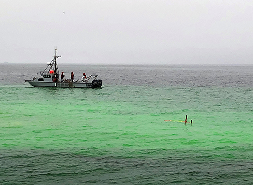
Some of the technology developed thus far was demonstrated to U.S. Coast Guard and NOAA observers on September 27 in an open-water field test in Monterey Bay, California.
The use of such autonomous robots for oceanic sampling/monitoring is not a new idea, but this device has some advancements that could allow it to detect and characterize subsurface oil in 4-dimensions (3-dimensional space over time) and transmit it to shore to improve oil spill responders’ situational awareness and improve decision-making during an emergency.
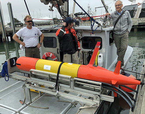
At 3.2 meters (roughly 10 feet) in length, 100 kilograms (225 pounds), and rated for depths of 300 meters (almost 1,000 feet), this red/yellow torpedo-like robot is a specialized ultra-marathoner with a range of 1,000 kilometers (620 miles), special capabilities to navigate under water and beneath ice, and equipped with an array of sensors. For last week’s demonstration, on-board instruments detected light levels, conductivity, temperature, depth, dissolved oxygen as well as a fluorometer-based detector to sense oil in the water column. Supplemental/replacement payloads can also include other technologies too, including water sampling devices and detectors for bioacoustics, bioluminescence, chlorophyll, or others if needed.
In Monterey Bay, the Tethys LRAUV was deployed near a cloud of green fluorescein dye (to simulate dispersed oil) and programmed to swim a "yo-yo" pattern (0.5-6 meters depth) as it moved through the plume in different directions; surfacing every few minutes to transmit/receive data from the control vessel and verify its location. Data was then transmitted to shore by cellular connection and made available to researchers for review and interpretation. As the project progresses, the hope is that this LRAUV will be capable of providing a 3-dimensional picture of subsurface oil in near real-time without having to surface to communicate/navigate; instead, accomplishing such tasks (and possibly even re-charging it’s batteries) by connecting to specialized docking sites attached to the seafloor, the ice, or a data buoy.
For more information, contact Jordan Stout.

