Great Lakes ERMA
Visit Great Lakes ERMA to visualize data and explore the region.
Introduction
The Great Lakes are the largest freshwater system on Planet Earth. Shared with Canada and indegenous communities on both sides of the border, these inland seas provide water for consumption, transportation, and industry. These lakes also face historic challenges from industrial pollution, and modern challenges like invasive species and harmful algal blooms.
Great Lakes ERMA is used to facilitate pollution response, cleanup, and restoration and store environmental data like habitat types, water levels and the most comprehensive collection of contaminant data in the region. NOAA’s ERMA is a critical tool for equipping experts to coordinate with partners and natural resource managers, including the Environmental Protection Agency, NOAA Great Lakes Environmental Research Laboratory, and State and Tribal partners, across the Great Lakes region.
Emergency Response
- NOAA uses Great Lakes ERMA to assess natural resources at risk from pollution, plan for and track injury assessment, and determine appropriate restoration in the event of an oil or chemical spill.
- In 2015 ERMA was heavily relied upon to respond to a leaking shipwreck, the Tank Barge Argo which sank in 1937. NOAA served as the common operating picture displaying over 25 trajectory forecasts for surface oil slicks and weather, in addition to environmental, physical and weather data in support of the U.S and Candadian responders.
Restoration
- Great Lakes ERMA allows environmental conditions to be compared across the region and over time,which helps NOAA track the progress towards restoring Great Lakes Areas of Concern and healthy freshwater ecosystems.
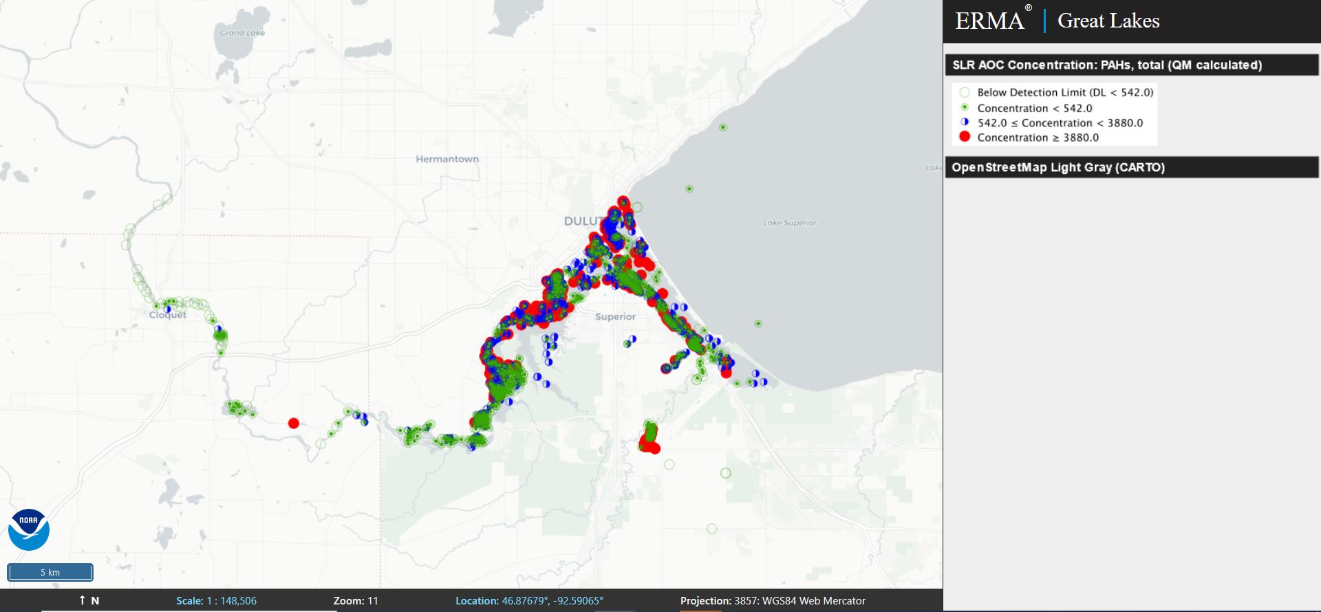
- By combining environmental data along with recreational, tribal, commercial, and manufacturing information Great Lakes ERMA supports NOAA’s work on sites including the Kalamazoo River and St. Louis River.
- With funding from the Great Lakes Restoration Initiative (GLRI), NOAA has partnered with Wisconsin and Minnesota to standardize and serve environmental data for the St. Louis River Area of Concern through NOAA’s DIVER query tool and map data layers in Great Lakes ERMA.
- In partnership with NOAA’s Mussel Watch Program, the longest running contaminant monitoring effort in the U.S., Great Lakes ERMA displays sampling stations and results, and provides direct access to NOAA DIVER for query and download of contaminant data
more images

 An official website of the United States government.
.png?itok=O1z2PKSr)

