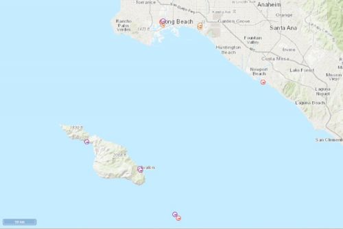
Map of the Month: Abandoned and Derelict Vessel Inventory Map
The Environmental Response Management Application (ERMA®) is NOAA’s online mapping tool that integrates both static and real-time data, enabling users to quickly and securely access, analyze, and display spatial data. The "Map of the Month" series highlights unique maps from throughout ERMA's use and history.
When owner’s don’t claim responsibility for boats washed away and damaged during storms, these abandoned and derelict vessels can cause issues for marine habitats. The impact of these vessels thrown into wetlands, beaches, and shorelines can cause physical damage to the environment. These vessels can also become hazards for boat traffic and outdoor recreationists on the shore. Furthermore, the oil, batteries, and marine debris left on board can leak into the environment and negatively impact fish and wildlife.
Assessing, removing, and safely disposing of abandoned and derelict vessels requires a big investment, and the laws addressing this issue vary greatly across the United States. Coast Guard Sectors in California have partnered with NOAA to house and report this information. Vessels are continuously removed and added, and there is currently an ongoing effort for a nationwide database seeking collaboration between federal and state agencies.
View the abandoned and derelict vessel inventory in California via ERMA here.
This Map of the Month is brought to you by Adam Rotert from OR&R's Assessment and Restoration Division Spatial Data Branch.
 An official website of the United States government.
