Map of the Month: Coral Reef Monitoring and Damage Assessment in the Pacific Islands Region
The Environmental Response Management Application (ERMA®) is NOAA’s online mapping tool that integrates both static and real-time data, enabling users to quickly and securely access, analyze, and display spatial data. The "Map of the Month" series highlights unique maps from throughout ERMA's use and history.
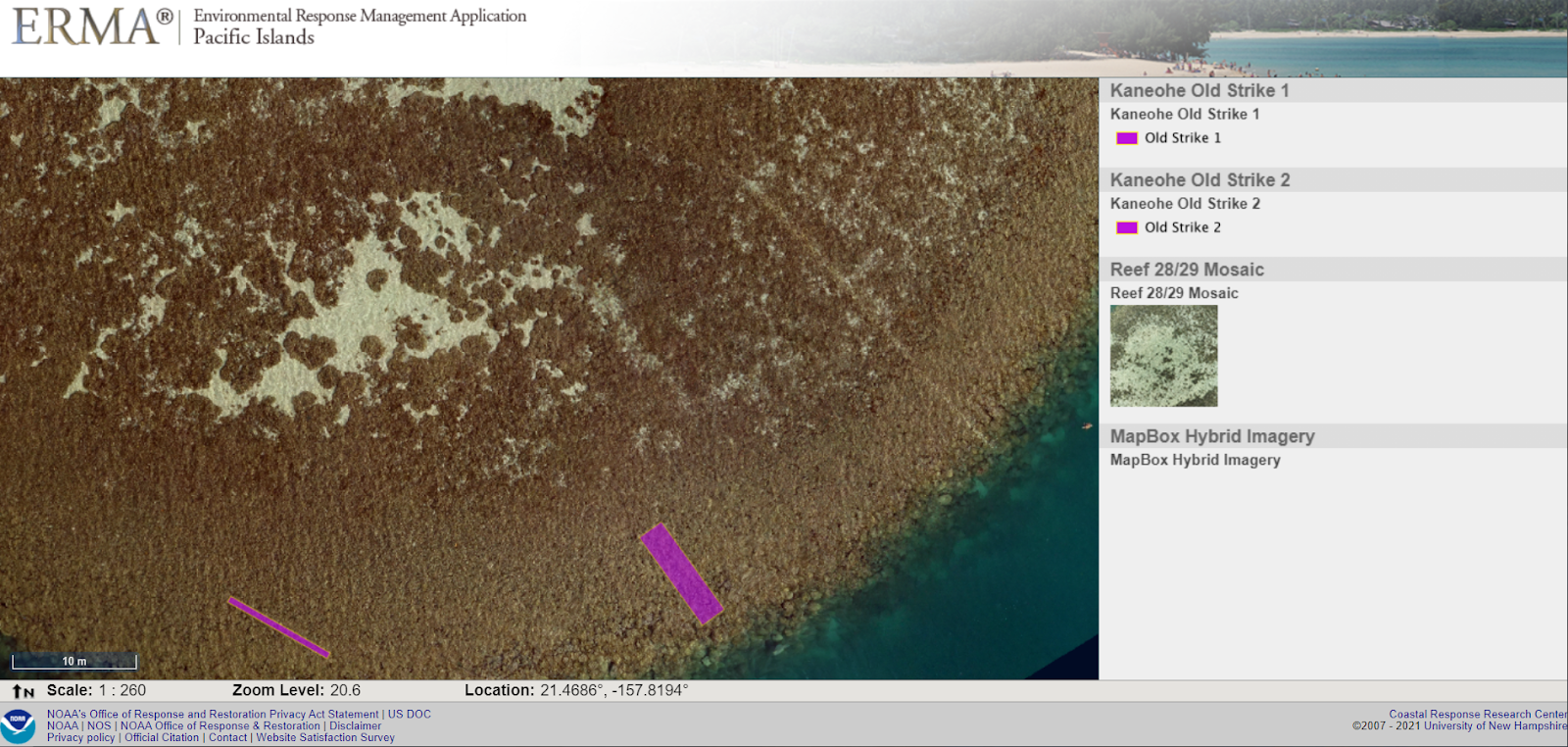
Map 1: These maps show Kaneohe Bay in Hawaii—a popular destination for recreational boaters, which unfortunately results in recurring vessel strikes and damage to patch coral reefs. This shows patch reefs in purple, and live coral coverage from blue-red.
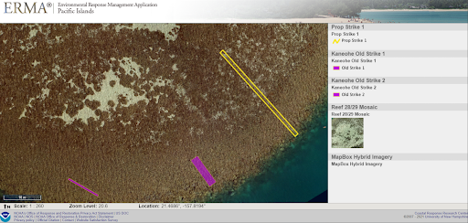
Map 2: NOAA has begun to use drones to capture and outline these groundings to devise protection strategies. In the image above, old prop scars are delineated in purple. Can you see the large prop scar on the eastern portion of the image?

Map 3: Here we see this new significant strike scar delineated in yellow. Comparing coral scars with recreational boat traffic allows scientists to predict potential coral injuries and develop plans to protect these important marine ecosystems.

This work using small Uncrewed System (sUxS) drone imagery to assess and protect coral reef health is part of a partnership between NOAA’s Office of Response and Restoration, the Disaster Preparedness Program, the NOAA Damage Assessment, Remediation, and Restoration Program, and the Papahānaumokuākea Marine National Monument. Together the group will address response and emergency coral restoration, habitat damage assessments, coral health monitoring, and collaboration between local, state, and federal agencies and nongovernmental organization groups to best protect Hawaii's coral reefs.
Link:
DARRP Coral Restoration UxS Pilot Project
DARRP Coral Restoration UxS Pilot Project Reef 28
This "Map of the Month" is brought to you by George Graettinger with the Office of Response and Restoration's Assessment Restoration Division. Special thanks to the NOAA Restoration Center’s Matt Parry and Rob O'Connor and PMNM’s Keolohilani Lopes. Their mapping was used in this "Map of the Month."
 An official website of the United States government.
