 An official website of the United States government.
 Map of the Month: Geographic Response Plan Information in the Pacific Northwest
The Environmental Response Management Application (ERMA®) is NOAA’s online mapping tool that integrates both static and real-time data, enabling users to quickly and securely access, analyze, and display spatial data.
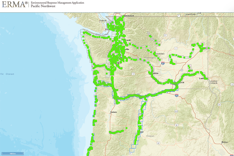
This month's map shows the Geographic Response Plans (GRPs) for Oregon and Washington. GRPs are guides for actions during an oil spill response. These plans help responders to deploy predefined strategies at previously identified areas of significant economic, cultural, and ecological value. They are designed to minimize the potential damage that an oil spill may have on these areas.
Working with both the Oregon Department of Environmental Quality Emergency Response Program and the Washington Department of Ecology Spill Prevention, Preparedness, and Response Program, NOAA has integrated the GRP data from both states into ERMA for use by responders. The GRP data is regularly updated in ERMA as the states make updates to the plans, ensuring that the most up-to-date data is available.
Users in ERMA can click on the GRP data and obtain a variety of information regarding the response plan strategies, including access points, boom placement locations, equipment needs, as well as links to the full PDF documents.
Click here to view the map online.
December’s Map of the Month comes from OR&R Spatial Data Branch’s Nicolas Eckhardt.