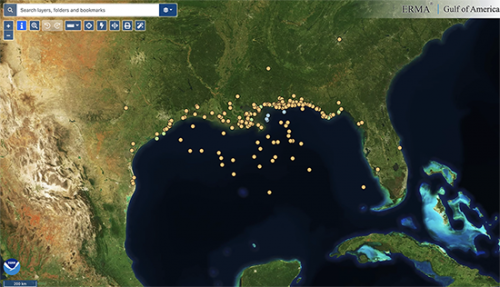
Map of the Month: Gulf of America Natural Resource Damage Assessment Funded Restoration Projects
The Environmental Response Management Application (ERMA®) is NOAA’s online mapping tool that integrates both static and real-time data, enabling users to quickly and securely access, analyze, and display spatial data. The "Map of the Month" series highlights unique maps from throughout ERMA's use and history.
NOAA’s DIVER application was originally created to integrate and organize millions of records of environmental assessment data and help reach the historic $8.8 billion natural resource damage assessment (NRDA) settlement in 2016 following the 2010 Deepwater Horizon oil spill in the Gulf of Mexico. The DIVER platform is now used by the federal, and state NRDA trustees to manage restoration project information and to provide the public with up-to-date reporting on the progress of restoration projects funded by this settlement.
There are currently more than 175 restoration projects ongoing across the Gulf of America (formerly Gulf of Mexico), with many more to come. By using DIVER Explorer, people can filter for resources they care about, including projects benefiting sea turtles or oysters, or filter by state to see what’s happening close to home. Information on restoration projects that are managed in DIVER is also available for visualization in Gulf of America ERMA, and in mapping applications such as the Gulf Spill Restoration Projects story map.
Learn more in the resources below:
 An official website of the United States government.
