 An official website of the United States government.
 Map of the Month: Marine Sanctuary Restoration Efforts
The Environmental Response Management Application (ERMA®) is NOAA’s online mapping tool that integrates both static and real-time data, enabling users to quickly and securely access, analyze, and display spatial data. The "Map of the Month" series highlights unique maps from throughout ERMA's use and history.
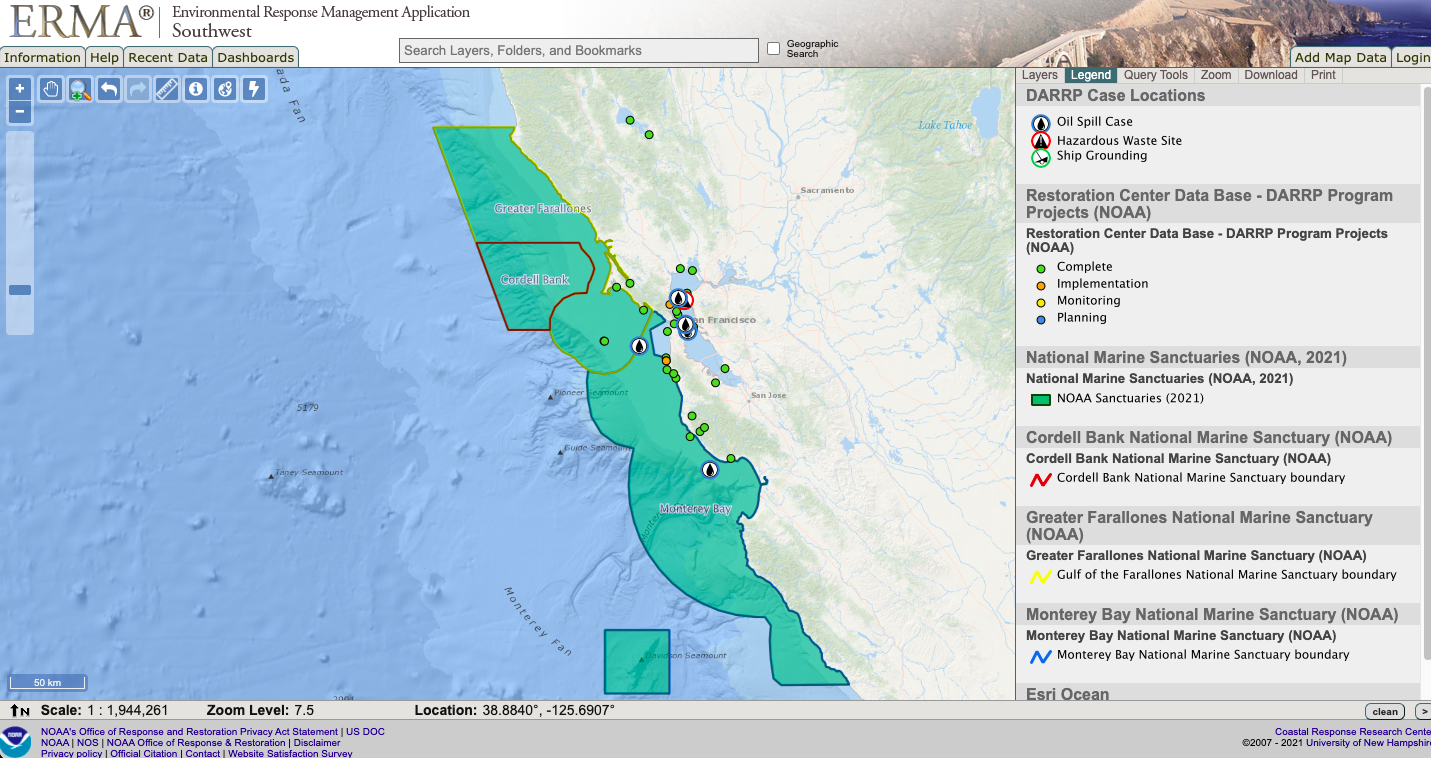
This month is Get Into Your NOAA Marine Sanctuary Month and OR&R is highlighting our ongoing work with NOAA's Office of Marine Sanctuaries. There are 13 sanctuaries around the country and the Damage Assessment, Remediation, and Restoration Program works to restore habitats after chemical releases. As of 2021 there are eight DARRP funded restoration projects within sanctuary boundaries across the U.S. and seven of those are located in California.
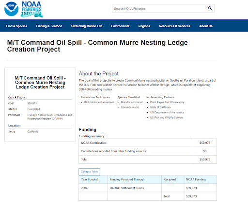
This map highlights restoration projects that focused on restoring marine sanctuary resources in Northern California. The projects demonstrate restoration implemented as a result of the Command Oil Spill. One project helped to create bird nesting habitats for the Greater Farallones National Marine Sanctuary and another increased outdoor recreational use and public access to the Monterey Bay National Marine Sanctuary.
ERMA provides a user with the ability to identify the status of the restoration project and then click a link to get more information on project description, status and funding from NOAA Fisheries Restoration Atlas.
View this map in ERMA Southwest here.
This "Map of the Month" is brought to you by Matt Dorsey and Megan Ewald from NOAA’s Office of Response and Restoration.
more images
more images