 An official website of the United States government.
 Map of the Month: NOAA Oil Spill and Waste Sites
The Environmental Response Management Application (ERMA®) is NOAA’s online mapping tool that integrates both static and real-time data, enabling users to quickly and securely access, analyze, and display spatial data. The "Map of the Month" series highlights unique maps from throughout ERMA's use and history.
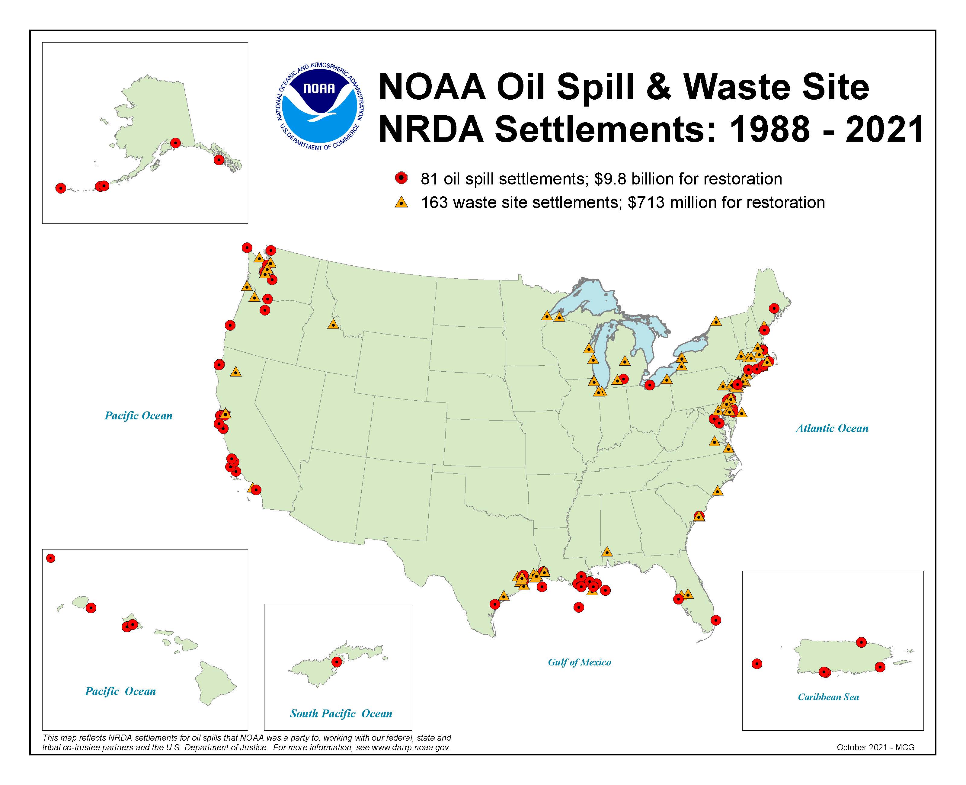
Over our 30+ year history, NOAA and our partners have helped recover over $10.5 billion to restore coastal ecosystems and communities after oil spills and hazardous waste pollution. This map shows the 81 oil spill sites and 163 hazardous waste sites across the country where we have reached settlements to fund restoration.
Restoration funds have been used to restore wetlands, beaches, reefs, corals, remove dams to restore fish passage on rivers, and to promote outdoor recreation by building parks, boat ramps, and fishing piers. These restoration projects also provide economic benefits to coastal communities, including underserved and indigenous communities often disproportionately affected by pollution.
To learn more about NOAA’s work in your area, visit our interactive “Explore Projects” map on the Damage Assessment, Remediation, and Restoration Program website or learn about DARRP's accomplishments.