 An official website of the United States government.
 Map of the Month: Tropical Storm Elsa
The Environmental Response Management Application (ERMA®) is NOAA’s online mapping tool that integrates both static and real-time data, enabling users to quickly and securely access, analyze, and display spatial data. The "Map of the Month" series highlights unique maps from throughout ERMA's use and history.
Tropical Storm Elsa: Rainmaker
 (1).jpg)
This map shows Tropical Storm Elsa as it approaches South Florida. This image is from 9 a.m. on July 6, 2021 and depicts the cumulative three-day precipitation forecast. NOAA’s Office of Response and Restoration works with the NOS Disaster Preparedness Program to track storm progress and help understand potential impacts to natural resources, navigation, and communities.
OR&R coordinates with the U.S. Coast Guard and the U.S. Environmental Protection Agency to catalog displaced vessels and other potential hazards to navigation in ERMA using SmartPhones and tablets.
View the Tropical Storm Elsa precipitation map here.
Tropical Storm Elsa: Forecast and Arrival
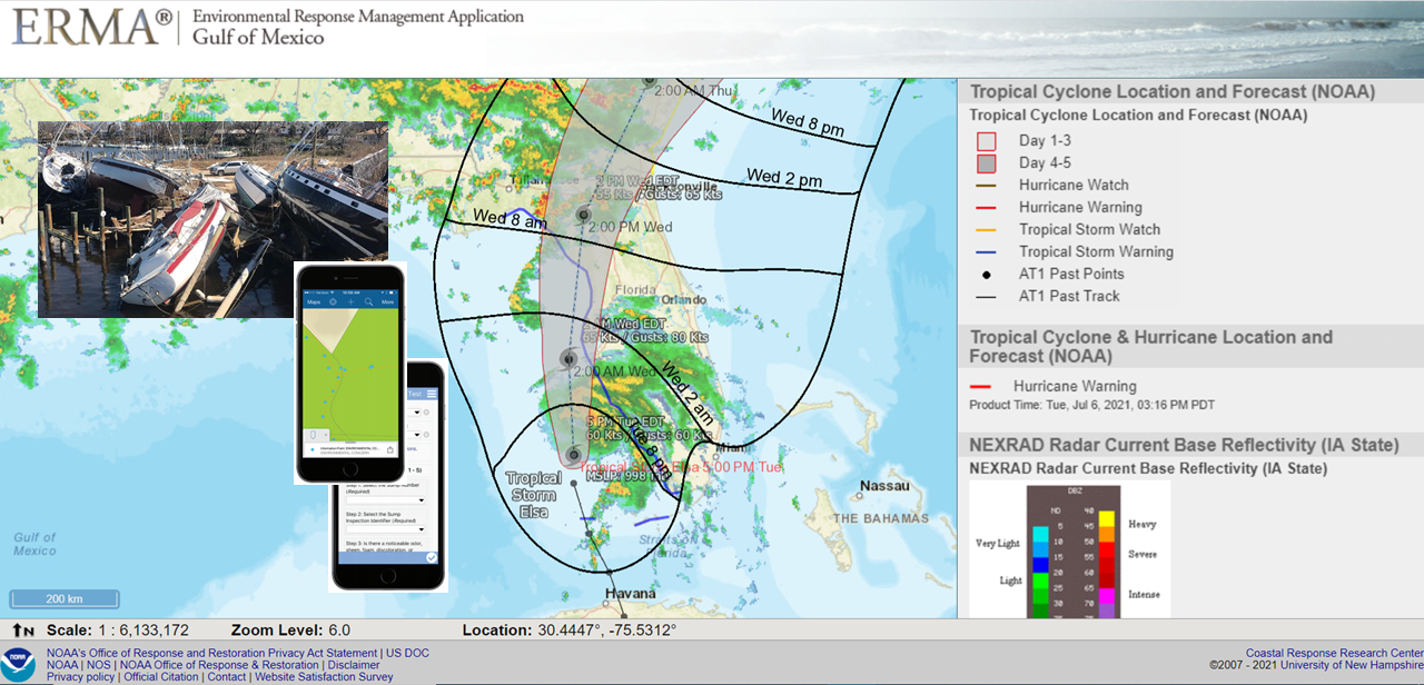
This map shows Tropical Storm Elsa as it approaches South Florida. This image is from July 6 and depicts the forecast path and time of arrival. The Office of Response and Restoration Disaster Preparedness Program tracks storm progress and helps document and remediate impacts to marine infrastructure.
OR&R coordinates with the U.S. Coast Guard and the Environmental Protection Agency to catalog displaced vessels and other potential hazards to navigation in ERMA using SmartPhones and tablets.
View the Tropical Storm Elsa forecast and arrival map here.
This "Map of the Month" is brought to you by George Graettinger and Megan Ewald from the OR&R Assessment and Restoration Division. Shout out to George Marino in the OR&R Disaster Preparedness Program.