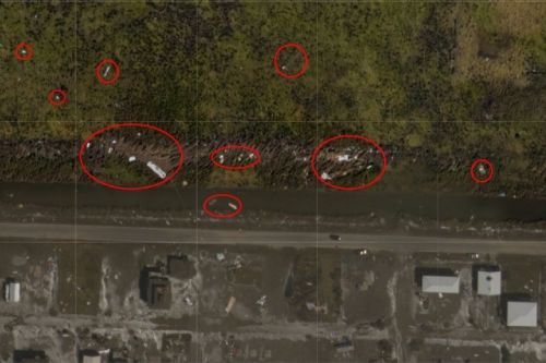
Marine Debris Program Supports Hurricane Laura Debris Response
Sept.1, 2020 — On Aug. 27, 2020 Hurricane Laura made landfall in the early morning hours as a Category 4 hurricane with reported wind speeds of 137 mph at Lake Charles, Louisiana, 30 miles inland from landfall on the coast.
Hurricane Laura created a preliminary estimate of 8 million cubic yards of debris but that amount is expected to increase as more data become available. The Federal Emergency Management Agency (FEMA) and Louisiana’s Governor's Office of Homeland Security and Emergency Management has called together a debris task force to evaluate debris issues and provide necessary information to impacted communities.
NOAA’s Marine Debris Program is one of four federal agencies supporting the debris task force and Gulf of Mexico Regional Coordinator Caitlin Wessel is serving as the marine debris subject matter expert. The program is providing impacted communities with the Louisiana Marine Debris Emergency Response Guide to help them determine responsible parties for removing various types of debris and best management practices for debris removal from sensitive environments such as marshes. The Marine Debris Program is also working with NOAA’s National Geodetic Survey, which provided aerial imagery, and the Office of Response and Restoration Spatial Data Branch to analyze debris targets in marsh areas in southwest Louisiana to improve the debris estimates and determine the best response.
 An official website of the United States government.
