NOAA Continues Support for California Oil Spill
OCTOBER 11, 2021 ─ On October 2, 2021, U.S. Coast Guard contacted NOAA regarding an unknown sheen in the water. Roughly 45 minutes later, NOAA captured satellite imagery, which became the basis for a NOAA Satellites Marine Pollution Surveillance Report, issued the same day, showing oil slicks extending for more than 30 miles along the coast. U.S. Coast Guard field teams investigating the information observed black oil roughly 3.25 nautical miles offshore and requested NOAA support in mapping the trajectory of the oil.

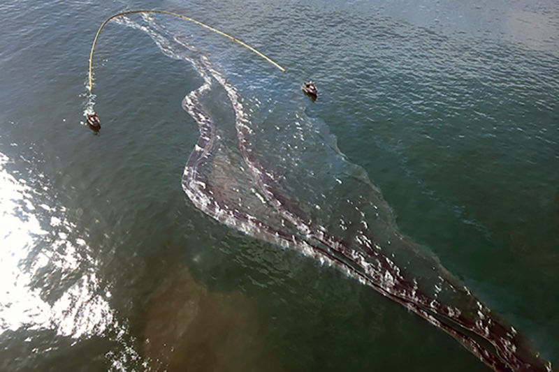
Crude oil is shown in the Pacific Ocean offshore of Orange County, Oct. 3, 2021. Image credit: U.S. Coast Guard.
NOAA is engaged in multiple ways:
- OR&R is providing scientific support, including modeling, as well as on-scene presence shifting from virtual to in-person beginning October 4, 2021.
- OR&R is also engaged with trustees on injury assessment for Natural Resource Damage Assessment.
- NOAA Fisheries is supporting the response effort by working with local partners on the recovery and rehabilitation of any oil-impacted marine mammals and sea turtles. NOAA Fisheries also supports the U.S. Coast Guard and all responders by assessing the impacts of response activities on threatened and endangered species.
- NOAA Satellites Marine Pollution Surveillance Reports are providing synoptic views of surface oil.
- NOAA’s National Weather Service forecasts are supporting the response including scientific support products (NOAA wind forecast data and currents from a combination of high frequency radar observations and models are driving NOAA National Ocean Service modeling).
For further information, contact Doug.Helton@noaa.gov.
Last updated
Tuesday, November 8, 2022 1:42pm PST
