New Job Aids and Training on Uncrewed Aircraft Systems Guidance for Oil Spill and Disaster Response, Assessment, and Data Management
OR&R and the U.S. Coast Guard are advancing oil spill and disaster response through cutting-edge research and development focused on oil spill science, remote sensing technology, and data delivery.
MAR. 24, 2025 — Under a five-year operational agreement, NOAA's Office of Response and Restoration (OR&R) and the U.S. Coast Guard (USCG) have committed to using OR&R’s web-based geographic information system tool ERMA® as the common operating picture for oil spills, related disaster support functions, and training. A common operating picture is a continuously updated overview of an incident compiled throughout an incident's life cycle, providing real-time situational awareness across all levels of incident management and across jurisdictions.
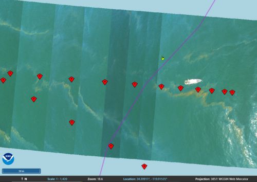
To support this interagency agreement, OR&R and partners have developed best practices and training materials to aid USCG pilots and other responders in effectively collecting and delivering imagery for oil characterization and mapping. This effort also identified tools to produce shore-based and open-water image maps and mosaic imagery that meet NOAA standards and requirements for data packaging. Commonly used in remote sensing, mosaic imagery is a technique where a series of adjacent, overlapping images—typically aerial or satellite photos—are “stitched” together to create a single, seamless image that provides an easy to interpret overview of a large area.
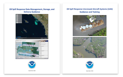
OR&R and partners recently released these resources in the form of two comprehensive job aids, titled "Oil Spill Response Uncrewed Aircraft Systems (UAS): Guidance and Training," and "Oil Spill Response Data Management, Storage, and Delivery Guidance.” These resources cover every stage of response operations for the use of UAS use for shoreline and on-water spill response—from mission planning and data collection to image mapping and short and long-term data storage—ensuring seamless integration with NOAA systems like the Data Integration Visualization and Reporting (DIVER) warehouse and ERMA.
Key highlights of the new resources include training materials for USCG pilots to capture imagery for oil characterization and mapping; tutorials and a quick reference matrix for selecting optimal remote sensing tools based on specific response needs, and updated resources integrated into USCG Aviation Training Center programs and UAS flight Operations protocols.
These job aids expand OR&R's resource library, including the Open Water Oil Identification Job Aid for Aerial Observation, published in 2016 to standardize language and streamline assessments of oil appearance and distribution on water. Together, these tools equip response teams with the knowledge and resources to act swiftly and effectively during critical situations.
Funding for the Oil Spill Response Uncrewed Aircraft Systems (UAS) Guidance and Training Job Aid was provided by the USCG Great Lakes Oil Spill Center of Expertise (GLCOE). This job aid was developed by Research Planning, Inc. in close collaboration with USCG’s GLCOE and NOAA OR&R.
 An official website of the United States government.

