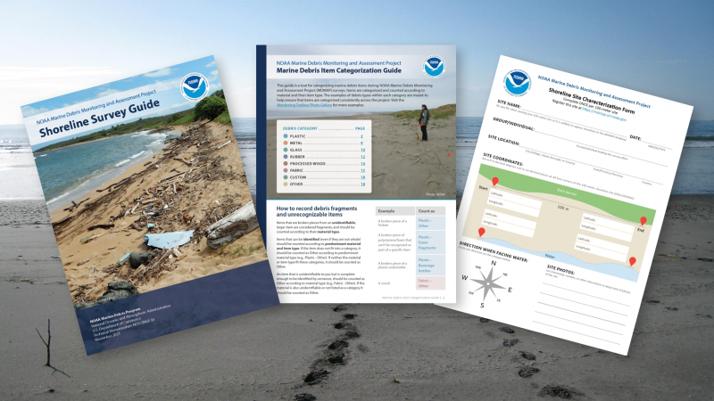
Now Available: New Tools for Collecting and Exploring Marine Debris Data
NOV. 21, 2022 — On Nov. 3, the NOAA Marine Debris Program released an updated toolbox of materials to help assess marine debris on shorelines through NOAA’s Marine Debris Monitoring and Assessment Project (MDMAP).

Through MDMAP, partners and volunteers around the world survey and record the amount and types of marine debris on shorelines, answering questions like How much marine debris is on our shores? What kind of debris is it, and where does it come from? Are these things changing over time?
The updated Monitoring Toolbox is a collection of resources to support volunteers in conducting surveys and using the data they collect, including:
- Training videos in English and Spanish that walk you through each step, from choosing the right site all the way through learning how to categorize and record your data in the MDMAP database
- A Shoreline Survey Guide with written instructions and diagrams on how to conduct a survey and collect important information
- A Marine Debris Item Categorization Guide, which describes how to count and categorize marine debris with photo examples
- Field datasheets, which include a quick guide to conducting a survey
- Examples of publications and projects that have used MDMAP data
- An open access MDMAP Database for data entry, exploration, and retrieval
- And more!
If you are interested in joining the network of MDMAP volunteers, watch the introduction video on our website to get started surveying a shoreline near you. At any point, reach out to project staff at md.monitoring@noaa.gov with questions.
