 An official website of the United States government.
 GOODS: Downloading Ocean Currents Forecasts
Output from numerous forecast models for ocean currents can be accessed through GOODS. Sources range from global-scale models run by NOAA National Weather Service and the U.S. Navy to high-resolution models for coastal waters and the Great Lakes. These forecast products use different hydrodynamic models with grid types ranging from regular to curvilinear to unstructured triangular meshes. Upon selection of a region of interest, GOODS provides the output from these models in a format that can be loaded directly into GNOME.
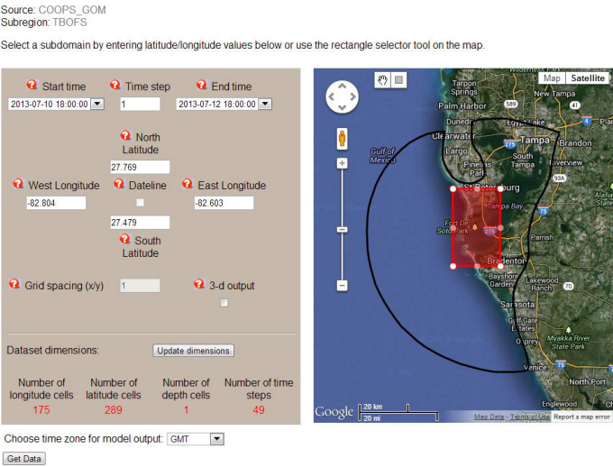
The GOODS interface for downloading forecasts from ocean currents models—in this case, the NOAA Center for Operational Oceanographic Products and Services Tampa Bay Operational Forecast System. The red selector rectangle shows a user-selected subregion within the model domain (black line) that will be included in the output file. Subsetting spatially and in time can reduce the download time for model outputs.
Return to the main GOODS page.
Questions: Contact us with your questions, comments, or suggestions for GOODS.
Last updated
Thursday, October 31, 2013 5:01pm PDT