Remembering Cosco Busan: An Overview of the 2007 Oil Spill
This is the first in a week-long series of blogs in remembrance of the Cosco Busan oil spill that happened 10 years ago on Nov. 7, 2007. In this blog, Patrise Henkel offers an overview of the spill, its impact on the San Francisco Bay and the outcome that followed.

The Spill
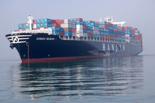
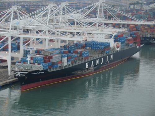
In the decade since marine vessel Cosco Busan struck the San Francisco Bay Bridge, our concept of a big oil spill has changed. Compared with the Deepwater Horizon oil spill, which gushed millions of gallons into the Gulf of Mexico, Cosco Busan’s 53,000 gallons seems small. Yet that incident had a major impact on the Bay Area — on both the habitat and the public outlook.
Initial reports were that only 140 gallons were spilled. However, those estimates were quickly revised when it became obvious that more than 50,000 gallons of thick tarry oil were spreading across the Bay. This bunker fuel congealed in the cold water and strong winds and tides swiftly carried it to the bay shorelines and as far as Pacific beaches.
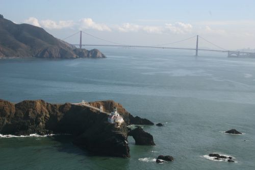
The closed beaches around the Bay and up the coast brought local and national attention to the spill. Oil was found as far north as Muir Beach, and south as far as Pacifica. Miles of beaches were closed; fishing and crabbing were suspended. An estimated one million user-days were lost.
Bunker fuel proved especially toxic to sea life. Fish and birds were highly impacted, with more than 6,800 dead birds documented, including many marbled murrelets, a threatened species. The timing was bad for herring who spawn at that time of year. Fish embryos are particularly vulnerable to even traces of bunker fuel, developing developmental defects that decimated their numbers in 2008. As the herring are a major food source for salmon and other large fish, and marine mammals as well, more wildlife were affected.
The Outcome
Through the natural resource damage assessment (NRDA) and resulting settlement, the ship’s owners were held accountable for damages incurred. A historic settlement of $44.4 million was reached with the responsible parties to pay civil penalties, reimburse remaining costs of the emergency response, cleanup and damage assessment, and to provide more than $30 million for projects to restore injured natural resources and compensate for lost recreational uses.
"The repercussions from this oil spill led to many changes in how we prepare for, respond to, and assess effects from such incidents in the Bay Area, the state, and even nationally,” noted Dr. Rob Ricker, branch chief of NOAA’s Assessment and Restoration Division.
What began as a pilot’s blunder in the fog has since led to an improvement in how we respond to and recover from such incidents. Not only that, the Cosco Busan incident raised awareness throughout the Bay Area about protecting local resources and led to significant habitat improvements for birds, aquatic vegetation, fish and shellfish.
For more information on the Cosco Busan oil spill, watch for our upcoming blogs detailing the initial call and the emergency response efforts, the assessment phase, a close-up look at the Greater Farallones National Marine Sanctuary’s response efforts, and a concluding piece on the continued restoration efforts.
Patrise Henkel is a communication specialist with NOAA Fisheries.
RESOURCES
To learn more about the Cosco Busan oil spill, you can also visit the resources below:
- Cosco Busan oil spill image gallery
- Making Waves podcast: episode 84 “Cosco Busan Settlement,” and episode 91, “Restoring San Francisco Bay.”
- Related articles:
- $36.8 Million Settlement to Restore Natural Resources and Improve Recreational Opportunities in Areas Affected by Cosco Busan Oil Spill Will Address Impacts from Ship that Struck the Bay Bridge
- $44 Million Natural Resource Damage Settlement to Restore San Francisco Bay After Cosco Busan Oil Spill
- DARRP Team Members Receive Award for Work on Cosco Busan Oil Spill Settlement
- Buoys Serve as Latest Gardening Tool for Restoring Eelgrass in San Francisco Bay
- California Department Fish and Wildlife
- Damage Assessment, Remediation, and Restoration Program Cosco Busan case page
- National Transportation Board accident report and presentation
 An official website of the United States government.


