Updating Aerial Observation Capacity with Current Technology
AUG. 22, 2022 — One of the primary ways OR&R supports the U.S. Coast Guard during oil spills is by providing trajectories (oil spill transport forecasts) which help in determining where the oil will go so that the appropriate response (cleanup or protection) strategies can be planned for and implemented.
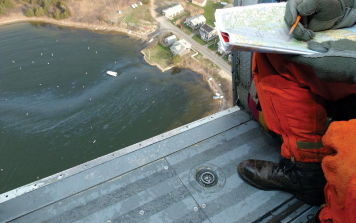
Conducting routine overflights to collect timely observations of oil conditions (location, extent, characteristics) is critical to updating and improving the accuracy of those trajectories. NOAA scientific support coordinators and other trained aerial observers in OR&R’s Emergency Response Division are often tasked to conduct these overflights and pass observations to the oceanographers who are continually updating the trajectories.
With funding from the Disaster Preparedness Program, ERD recently developed a customized aerial observation tool that uses current advancements in mobile application technology for real-time field data collection and sharing via ArcGIS platforms. This tool allows users in ERD to conduct aerial observation surveys and immediately share those georeferenced observations (notes, photos, etc.) with other response personnel in a secure GIS platform. The new tool is currently being tested and evaluated for broader distribution.
Learn more: