At the Coast Guard Academy, Students Get a Dose of Real-World Response Tools
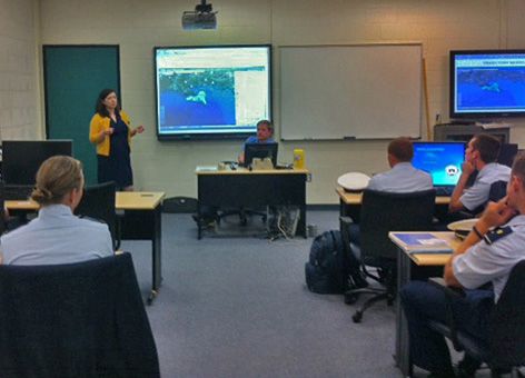
NOVEMBER 1, 2013 -- Students wearing crisp, blue uniforms lean in to get a better look at the map of the Gulf of Mexico being projected at the front of the small classroom.
Their normal Friday GIS class at the United States Coast Guard Academy in New London, Conn., has been taken over by two mapping specialists from NOAA's Office of Response and Restoration. Kari Sheets and Jay Coady are standing in front of the classroom of cadets to introduce these future U.S. Coast Guard responders to an important tool they may use one day in the midst of a hurricane or oil spill response.
The tool is NOAA's Environmental Response Management Application (ERMA®). ERMA is an online mapping tool that integrates both static and real-time data, such as ship locations, weather, and ocean currents, in a centralized, interactive map for environmental disaster response.
Having all the latest information in an easy-to-use format provides environmental resource managers with the data they need to make informed decisions about where and how to deal with a pollution threat when it happens. NOAA and the University of New Hampshire developed ERMA with the U.S. Coast Guard, U.S. Environmental Protection Agency, and the Department of Interior.

To the Classroom and Beyond
By offering training and collaboration opportunities like this early in cadets' careers, NOAA and the Academy are providing future Coast Guard responders with the real-world knowledge and tools that they might encounter when addressing future pollution events.
One day this fall, Sheets and Coady taught three GIS classes that focused on ERMA, its capabilities, and how to use it once the cadets graduate from the Academy. The classes covered a general overview of the ERMA platform, how it fits in the Incident Command System structure, how it enables users to see and access data. They also included a live demonstration of the tool that highlighted recent data used in the response to Post Tropical Cyclone Sandy in 2012.
From Training to Explaining
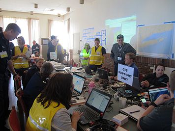
The lesson also integrated data from a training exercise held from September 17-19, which simulated a tug-and-barge grounding and potential oil spill in Long Island Sound as part of the National Preparedness for Response Exercise Program (PREP).
NOAA's Sheets and Coady began working with the Academy over the summer in preparation for this exercise in Long Island Sound. Coast Guard Academy GIS instructor LT Sabrina Bateman and Cadet Jaimie Chicoine helped provide and add data and information into ERMA for the PREP exercise, where ERMA was designated the common operational picture (COP). As the COP during an incident, ERMA brings together various types of information, providing a single place to display up-to-date information that is also accessible to all individuals involved in incident response operations. This consistency and accessibility helps improve communication and coordination among responders and stakeholders.
The Academy was able to use ERMA to load selected data from their internal databases. As a result of these early collaborations preparing for the drill, Sheets and Coady were invited to the Academy to guest lecture on ERMA for the GIS classes. The classes they taught went well, solidifying the Office of Response and Restoration’s connections with the Academy and resulting in an invitation back to teach again in the future.
In the meantime, LT Bateman plans on using ERMA in several of her GIS lectures and labs at the Academy to get cadets more accustomed to using it once they receive their assignments and enter Coast Guard stations around the country after graduation. This relationship has continued growing as the two organizations explore further opportunities for collaboration.
 An official website of the United States government.
