 An official website of the United States government.
 Fiscal Year 2022: Providing Scientific Expertise for Oil and Chemical Spill Response
The Office of Response and Restoration's Emergency Response Division (ERD) supports the U.S. Coast Guard by providing round-the-clock scientific expertise for oil and chemical spills in marine and coastal waters.
ERD's efforts facilitate spill prevention, preparedness, response, and restoration through its network of regionally distributed scientific support coordinators; a Seattle-based support team of scientists, technical experts, and software developers; and federal, state, and academic partners.

Critical Updates to Sensitivity Mapping in the Great Lakes
The Environmental Sensitivity Index (ESI) program produces datasets that map sensitive biological and human-use resources, along with a ranking of shoreline sensitivity to oil and chemical spills. Many ESI datasets in the Great Lakes contain outdated information from as far back as the 1980s, but FY22 saw the launch of a full overhaul to the region’s data, thanks to substantial new funding from the Great Lakes Restoration Initiative.
The funding will support updates to ESI datasets for Lake Ontario (contract awarded in FY22), Lake Michigan (announcement coming soon), and lakes Huron and Superior (next year). ESI data for Lake Erie was also updated in FY22 thanks to additional support from the U.S. Coast Guard. In total, over $5 million will support updated data for more than 2,000 miles of shoreline, producing more than 200 maps, and improving coastal resilience in lakes where busy shipping routes and pipelines carry nearly 23 million gallons of oil per day. These funds are also initializing the creation of a nation-wide enterprise data solution for the ESI program, allowing OR&R’s critical data to keep up with the growing demands of the information-based blue economy.

Providing Scientific Support to the Government of Peru
In February 2022, OR&R scientists joined U.S. National Response Team members deployed to Lima, Peru to support the Peruvian government’s response to the release of nearly 500,000 gallons of crude oil into the maritime environment, which was deemed "the worst ecological disaster in the history of Peru." Twenty-four beaches and five natural reserve areas were threatened, as well as the region’s commercial and artisanal fisheries and the tourism industry.
The OR&R team provided oil trajectory modeling forecasts and analysis and site assessment. OR&R also collaborated with its partner, the Satellite Analysis Branch of NESDIS (National Environmental Satellite, Data, and Information Service) to obtain and analyze satellite imagery to provide greater detail about the spill.
Two OR&R scientists were later recognized with a prestigious Team Meritorious Honor Award from the Department of State for sustained efforts to advance international spill response assistance and the resulting critical assistance to nearly a dozen nations, often with OR&R’s support. These same scientists also received the esteemed Meritorious Team Commendation from the U.S. Coast Guard. OR&R’s scientific support demonstrates the dedication of the U.S. government to provide assistance to nations facing environmental crises.

Keeping Communities Safer with CAMEO Tools
OR&R continues to improve the CAMEO® software suite—an interactive suite that allows users to develop emergency plans before accidents or hazardous storms occur in order to keep communities safe, mitigate hazards, and get businesses back on track. These tools are available for free and offer online capabilities, making them vital aids for rural and low-income communities. Developed jointly by NOAA and the Environmental Protection Agency for 30+ years, the CAMEO suite has a large user community in the U.S. and internationally.
In FY22, the suite’s hazardous chemical database (CAMEO Chemicals) received a major update to improve key chemical data and enhance response recommendations. The update incorporated the latest Emergency Response Guidebook information from the Department of Transportation, including guides in English, Spanish, and French.
The CAMEO suite programs are all available online, and CAMEO Chemicals also has a website, mobile website, and mobile app (for iOS and Android). CAMEO Chemicals is NOAA’s most downloaded mobile app—and the popularity of this versatile program continues to grow each year. In FY22, the CAMEO Chemicals website had 4.2 million page views and 1.4 million visitors, with each value increasing over 400,000 since the prior fiscal year.
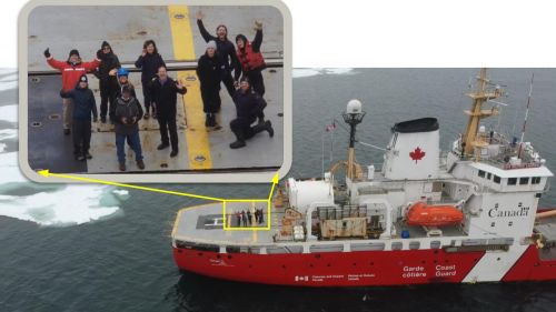
Oil on Ice Research for a Changing Arctic
In FY 2022 NOAA Office of Response and Restoration and U.S. Coast Guard scientists conducted research at three locations to test UAS (drone) and ROV (underwater) sensors to characterize oil on water in ice environments. At Cold Regions Research and Engineering Laboratory facilities in New Hampshire scientists created oil slicks, with and without ice, with standardized thicknesses in a test pool with a frozen ice surface, then simultaneously measured them from above and below. This allowed researchers to test our ability to see oil in water with ice and to verify the accuracy of these tools.
The team traveled to Alaska to characterize uncertainties, strengths, and limitations of these technologies under real-world environmental conditions. In Olitok, Alaska the team confirmed their ability to use these tools to produce consistent data and upload it into NOAA’s Emergency Management and Response Application (ERMA) for use by oil spill responders. Scientists then collected data aboard a Canadian Coast Guard vessel to map Arctic ice in water, identify complicating factors for drone sensors, and use the sensors to identify sensitive areas and resources. Collectively, this work bolsters resilience to oil spills and bolsters NOAA’s oil spill response capabilities in a changing Arctic.