OR&R Supporting Oil Spill in Oriental Mindoro, Philippines
MARCH 31, 2023 — In early March, the Government of the Philippines requested U.S. assistance in the response to an oil spill that occurred after the tanker Princess Empress sank on Feb. 28, while carrying more than 900,000 liters of industrial oil in rough seas off the coast of Oriental Mindoro. Since then, the tanker has been leaking both its cargo oil, as well as diesel fuel that was powering its engine.
The MT Princess Empress had sailed from Bataan en route to Iloilo with 20 crew members, all of whom were rescued by a passing cargo ship. The partially submerged tanker began to sink off Naujan and is now resting 389 meters (1,276 feet) below the surface. The vessel has resulted in oil impacts on multiple areas and shorelines.
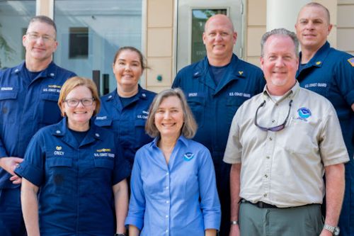
In response to the Philippine government’s request, the U.S. National Response Team (NRT) was activated on March 8. The NRT is a network of 15 federal agencies that provides guidance, assistance, and resources for managing pollution incidents. NOAA's Office of Response and Restoration (OR&R) represents NOAA on the NRT.
The Philippine government’s request included: oil spill and Incident Command team experts, and satellite imagery to inform oil spill monitoring and forecasting. NOAA is coordinating with NRT member agencies to assess and fulfill these requests.
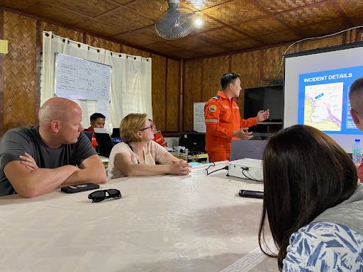
Through funding from the U.S. Agency for International Development (USAID), two oil spill response specialists from OR&R joined the NRT members deployed to Manila, Pola, and Calapan, Oriental Mindoro on March 17 to support the response. They met with representatives from the Philippine Coast Guard, the Japan Disaster Relief Team, USAID, U.S. Navy Supervisor of Salvage and Diving, U.S. Coast Guard, Embassy representatives, and a group of press/reporters.

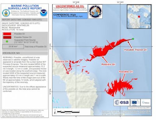
The NOAA team has been providing satellite imagery from the Satellite Analysis Branch of NOAA's National Environmental Satellite, Data, and Information Service. NOAA OR&R has been providing analysis and review of response methods, and guidance on topics such as reopening closed fisheries, appropriate protective equipment for clean-up workers, protection strategies for sensitive shorelines, aerial oil observation techniques, and appropriate shoreline clean-up endpoints. Additionally, OR&R staff are remotely supporting the scientific modeling efforts of the University of the Philippines Marine Science Institute using OR&R’s trajectory model, GNOME (General NOAA Operational Modeling Environment) to estimate the movement and fate of the spill.
Marine Pollution Surveillance Reports produced by NOAA’s National Environmental Satellite, Data, and Information Service, and maps produced by the Philippine Space Agency are assisting the Philippine government, and are posted to the website of The International Charter Space and Major Disasters.
Damage from the oil spill may affect biodiversity (including the global center of marine biodiversity located in the Verde Island Passage), tourism revenues, and food security in the area. Local authorities have declared states of emergency as the spill grows. The submerged vessel is being continuously monitored at the surface for oil releases (by an oil spill clean-up company) and at depth with a remotely operated vehicle (initial ROV from Japan, and now by U.S. Navy Supervisor of Salvage and Diving).
more images

 An official website of the United States government.

