Fiscal Year 2023: Assessing and Restoring our Nation's Shores After Pollution
OR&R's Assessment and Restoration Division (ARD) is responsible for evaluating and restoring coastal and estuarine habitats damaged by hazardous waste releases, oil spills, and vessel groundings.
Working with federal, state and tribal partners, ARD, through NOAA's Damage Assessment, Remediation, and Restoration Program, which includes the NOAA Restoration Center and General Counsel for Natural Resources, determines the harm to the environment and defines the amount of restoration required to compensate the American public for those impacts.
$92.8 Million Recovered from Pollution Settlements in Six States
This year, the Office of Response and Restoration and our partners recovered $92.8 million through pollution settlements for restoration, including from three oil spills and four hazardous waste (Superfund) settlements, often in disadvantaged communities disproportionately affected by pollution.
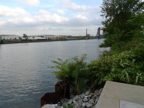
- $81 million to assess and restore injured natural resources and recreational losses from hazardous waste to benefit disadvantaged communities in the Lower Passaic River and Newark Bay, New Jersey.
- $5.3 million for restoration of injured natural resources and associated lost recreational opportunities from hazardous waste in Gloucester, Massachusetts.
- $2.78 million for restoration of natural resources injured by an oil spill in the Gulf of Mexico off the coast of Louisiana.
- $2.06 million for restoration of habitat to benefit salmon and wildlife injured by hazardous waste in the Lower Duwamish River.
- $0.99 million for restoration of Pacific herring spawning habitat and shellfish monitoring for seafood safety for local indigenous communities to compensate for an oil spill near Sitka, Alaska.
- $0.81 million to compensate for injuries to fish and other natural resources at the Dupont Hay Road hazardous waste site.
- $0.17 million for restoration from a diesel spill into the Buskin River, Alaska.
These actions add to over 30 years of pollution settlements recovering $10.7 billion for restoration of fisheries, wildlife, and coastal economies across the country.
Advances in Assessing Impacts of Pollution
In FY 2023, our scientists investigated a variety of scientific and economic issues designed to improve our ability to effectively assess and restore injured and lost natural resources. Four publications capture this work below:
Research on Impacts of Oil on Sand Beaches: OR&R scientists and partners published a paper on PAH (polycyclic aromatic hydrocarbons) uptake by talitrid amphipods (beach hoppers) via habitat (sand) and food (kelp) exposure. This important work indicates that talitrid exposure to PAHs from oil spills is driven by exposure to beach sediment and much less so by consumption of wrack. These findings highlight a key pathway for how negative impacts can occur to sandy beach ecosystems from oil spills.
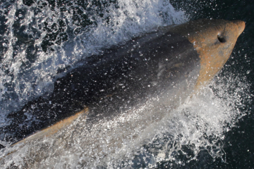
Workshop Report on Data Gaps and Oil Spill Impacts on Dolphins: OR&R and the Coastal Response Research Center (CRRC) co-sponsored a virtual workshop in 2022 to identify bottlenose dolphin data gaps in the Greater Houston area. The workshop report addressed data needs, distribution, health, and challenges of these dolphin stocks and how this information could support potential future natural resource damage assessments in the region. OR&R also produced a plain language summary and video on how to assess dolphin health after pollution.
New Publication on Discounting in Natural Resource Damage Assessment: OR&R economists co-authored a paper, Discounting in Natural Resource Damage Assessment. The paper provides natural resource damage assessment (NRDA) practitioners with alternatives, justifications, and implications of choices of the discount rate that is used to balance costs of injuries and benefits of restoration across time. The discount rate allows one to translate past and future outcomes into common, present values.
Synthesizing Research on the Open Ocean of the Gulf of Mexico: An OR&R scientist contributed to a publication that synthesized a decade of research on the open ocean of the Gulf of Mexico following the Deepwater Horizon oil spill in 2010. Research found that population declines of many open-ocean taxa appear to be ongoing a decade later and concluded that this largest of Gulf ecosystem components, like its deep-benthic counterpart, remains extremely fragile.
Technological Advances for NOAA’s Key Response and Assessment Tools: ERMA and DIVER
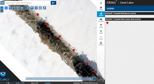
Environmental Response Management Application (ERMA®) is the common operational picture for NOAA and the U.S. Coast Guard during environmental responses like oil spills. It is an online mapping tool that integrates static and real-time data, such as oil spill footprints, weather, and ocean currents, in a centralized, easy-to-use format for environmental and emergency responders. In addition to ERMA, OR&R deploys the Data Integration Visualization Exploration and Reporting (DIVER) data warehouse to provide comprehensive data services to our response and assessment missions.
This year, the teams behind ERMA and DIVER made significant strides in enhancing the tools’ abilities to swiftly process and display field-collected data in near real-time. These advancements substantially reduced the time required between the collection of drone imagery to its seamless integration on the map interface. Furthermore, ERMA achieved near instantaneous data display from mobile devices. This transformative process was successfully showcased in support of two prominent U.S. Coast Guard (USCG) exercises: the Oil Spill Mapping Training for Coast Guard Uncrewed Aircraft Systems Pilots and the Collection of Data from an Icebreaker in the Great Lakes exercise. During the exercise, drone imagery was seamlessly uploaded to DIVER and posted to ERMA by teams still in the field aboard vessels. During a separate shoreline training held in Mobile, Alabama, field teams rigorously tested mobile devices for functionality and efficiency while transmitting real-time field team data—including forms and photos—for immediate display within ERMA.
These technological upgrades ensure that environmental resource managers have the critical tools and data necessary to make informed decisions during emergency response, damage assessment, recovery, and restoration.
 An official website of the United States government.


