 An official website of the United States government.
 ESI Mapping Workshop
On May 1-3, 2012, at the Disaster Response Center in Mobile, Ala., NOAA's Office of Response and Restoration (OR&R) hosted a workshop focused on the usability of the current ESI maps and data and envisioning the ESI products of the future. OR&R thanks all participants, whether you completed the ESI Survey, helped to organize the event, presented on one of the topics, or contributed to the discussions as a workshop participant. We value your input and ideas, which will help define the future of ESI mapping.
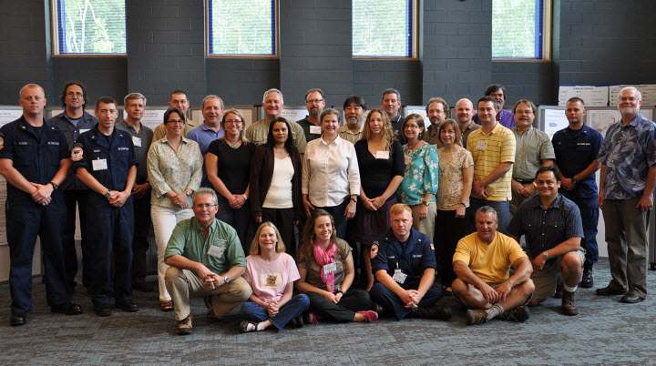
Workshop Participants
In group discussions and break-out sessions, 40 participants, representing 12 coastal states and two countries, shared a wealth of experience and ideas regarding which aspects of ESI maps and data work well, which aspects do not, and ideas and features to incorporate in the future. Participating governmental agencies included NOAA's Disaster Response Center, Special Projects Office, Coastal Services Center, and National Ocean Service; U.S. Coast Guard; U.S. Fish and Wildlife; Texas General Land Office; California Oil Spill Prevention and Response; Florida Fish and Wildlife Research Institute; Alabama Department of Conservation and Natural Resources; Delaware Department of Natural Resources and Environmental Control; and New York Department of Environmental Conservation. Non-governmental participants included staff from Research Planning, Inc.; Moran Environmental; Oceana; and the University of Aveiro, Portugal.
ESI Survey Results
In order to ensure that we addressed the "wants and needs" of the ESI community, we developed an ESI user survey to better understand what users like and dislike about the current ESI products, as well as what they would like to see in the future. The survey results provided a starting point for some of the workshop sessions. Results of the survey [PDF, 9.1 MB] also provided some interesting insight into how oil spill responders and planners use ESI products.
Presentations and Notes
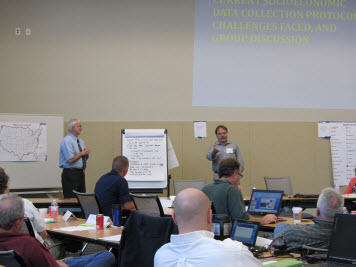
Presentations and discussions covered five primary topics:
- ESI Data Content
- ESI Tools and Online Mapping Services
- Use of ESI Data in Planning and Response
- The ESI Cartographic Product
- ESI Training and Outreach
PowerPoint presentations for some of the workshop sessions can be downloaded using the following links. Summaries of the break-out sessions are listed below these links.
- Meeting Goals, Results of the User Survey [PPT, 14.2 MB], Jill Petersen, NOAA OR&R ERD
- Status of Current ESI Mapping Projects [PPT, 100 KB], Jill Petersen, NOAA OR&R ERD
- Shoreline, Biology, and Human-Use Data Collection and Introduction [PPT, 168 KB], Mark White, Research Planning Inc. (RPI)
- Shoreline Classification [PPT, 10.2 MB], Zach Nixon, Chris Locke, RPI
- Biology Data Collection and Integration [PPT, 15.9 MB], Chris Boring, Jen Weaver, RPI
- Identifying Important Ecological Areas (IEAs) [PPT, 83.3 MB], Jeffrey Short, Oceana
- Use of ESI Atlases/Data in Contingency Planning and Response [PPT, 30.4 MB], Richard Knudsen, Florida Fish and Wildlife Research Institute (FWRI)
- Overview of NOAA’s Special Project Office, Web Services, NOAA CMSP Data Registry Tool [PPT, 8.2 MB], Robby Wilson, NOAA Special Projects Office (SPO)
- Packaging ESI PDFs as Web Services [PPT, 11.8 MB], Robb Wright, NOAA SPO
- ESI Data Viewer – an online mapping application [PPT, 5.7 MB], Nipa Parikh, NOAA SPO
- ESI Data, Query, and Tools in ERMA [PPT, 12.9 MB], George Graettinger, Amy Merten, NOAA OR&R ARD
- Florida Marine Spill Analysis System (FMSAS) [PPTX, 4.5 MB], Richard Knudsen, Florida FWRI
- ESI Data Online @ ESIonline – Pilot Project [PPT, 19.6 MB], Mark White, Chris Locke, RPI
- The GeoPDF Product [PPT, 6.4 MB], Robert Barron, Steven Buschang, Texas General Land Office (GLO)
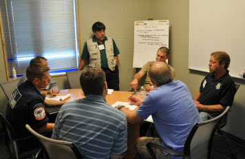
Discussion summaries from a number of break-out sessions are also available:
- Shoreline Session [PDF, 32.0 KB]
- Biology Session [PDF, 32.5 KB]
- ESIs and Geographic Response Plans (GRPs) [PDF, 36.3 KB]
- Cartographic Session [PDF, 47.9 KB]
- Training [PDF, 28.8 KB]
- Outreach [PDF, 32.8 KB]
General workshop notes:
- Workshop Notes [PDF, 150.0 KB]
New Blog and Email List
To facilitate ongoing communication and sharing among workshop participants and all ESI users, OR&R has launched the NOAA ESI Blog. The intent of the blog is to provide a forum where ESI users can share relevant happenings in their areas and participate in discussions on current and future ESI products. If you are unable or prefer not to access the blog, but are still interested in seeing the primary posts, please email the ESI Program Manager, asking to be added to an email list to receive blog content in that format.