Back to top

See Restoration in Action for California's Kelp Forests

Short title: 
Restoring California's Kelp Forests

JUNE 12, 2014 -- In July of 2013, a large-scale project to restore kelp forests began off the Palos Verdes peninsula of California. The Bay Foundation, with funding and technical assistance from NOAA's Montrose Settlements Restoration Program, coordinated the effort to remove overpopulated and undernourished sea urchins from urchin barrens. The large numbers of sea urchins in these areas decimate kelp forests by eating every newly settled kelp plant before they have a chance to grow. The good news is that these restoration efforts are working. Thanks to volunteer divers, commercial urchin divers, researchers, and local nonprofit groups, southern California's kelp forests are on the road to recovery. Check out the before and after photos to see the radical difference this project is making. In just weeks after divers clear urchins, newly settled kelp and algae can be seen growing. In the before photo, you can see what the area's nearly 100 acres of urchin barrens look like—rocky reef covered in dense clusters of spiny purple urchins. In the after photo, taken several months after restoration began, long strands of giant kelp reach from the seafloor up toward the water's surface. At some of the restoration sites, kelp have already grown more than 25 feet in length, creating better habitat for fish and other marine life.

Left, purple sea urchins on a rocky reef. Right, young kelp growing tall.
On the left is an urchin barren before divers cleared it of excess purple sea urchins and on the right is newly settled kelp already growing tall several months after restoration. (NOAA)

To date, volunteers have cleared roughly eight acres of reef habitat at four restoration sites, which are in various states of recovery, but we still have plenty more work ahead. In the next two to three years, we hope to reestablish between 75 and 80 acres of kelp forest on the Palos Verdes shelf. For more information, check out:

  • Progress and background on the project [PDF], which includes how you can get involved.
  • A video podcast about the project from Thank You Ocean.
  • More background on the project—including how NOAA got involved—and a video showing what it's like swimming along an urchin barren.
Healthy kelp forest in southern California.
Healthy kelp forest in southern California. (NOAA)
Node Weight: 
2

What Have We Done for Endangered Species Lately?

Short title: 
Endangered Species Day 2014

MAY 16, 2014 -- Endangered species have a tough time of it. These plants and animals have been trampled, hunted, contaminated, and pushed out of their homes by humans to the point that their very existence on this planet becomes dangerously uncertain.

In the United States, this is when the federal government steps in to list a species as threatened or endangered under the 1973 Endangered Species Act.

Over 40 years later, this critical piece of legislation has had many successes in protecting native animals and plants and the natural areas where they live—perhaps most notably bringing back the national symbol, the bald eagle, from the brink of extinction. Yet with more than 1,500 types of animals and plants remaining threatened or endangered in the United States, we still have more work to do.

On May 16, 2014, we're going to take the time to recognize this very important national conservation effort by celebrating Endangered Species Day and the many ways, big and small, each of us can help save our nation's incredible array of plants and animals from extinction—like the now-recovered brown pelican!

Tools for Protecting Species During Oil Spills

So, what has NOAA been doing for endangered species? One example is the Office of Response and Restoration’s special data mapping tools that come into play during oil spills.

When an oil spill occurs along the coast, one priority for our office is identifying whether any threatened or endangered species live in the area near the spill. The responders dealing with the spill have to take into account factors such as what time of year these protected species are breeding or how they might come into contact with spilled oil or the response. This means knowing whether young Chinook salmon may be migrating out to sea through an estuary where a ship may have accidentally discharged fuel. Or knowing if the beaches where spill responders need to clean up oil are also important nesting grounds for a shorebird such as the piping plover.

Our biologists and ecologists help provide this kind of information during an oil spill response, but our office also produces tools to organize and display all of this information for both NOAA and oil spill planners and responders outside our agency. One of these tools is NOAA's Environmental Sensitivity Index (ESI) maps. These maps characterize coastal environments and wildlife based on their sensitivity to spilled oil. The main components of these maps are sensitive wildlife, shoreline habitats, and the resources people use there, such as a fishery or recreational beach.

A related Geographic Information Systems (GIS) tool, the Threatened and Endangered Species Geodatabases, make up a subset of the original ESI data from our maps. These data focus on the coastal species and habitats that are federally and/or state listed as endangered, threatened, protected, or as a species of concern. These databases offer a more user-friendly option to access some of the most critical biological information for a region.

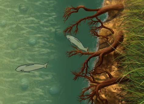
In the example below, you see a map of Great South Bay from the Long Island ESI atlas. The colored shapes (red, blue, green, and maroon) indicate where the piping plover, shortnose sturgeon, eastern mud turtle, and seabeach amaranth occur in June.

Screen capture of Environmental Sensitivity Map showing habitat of some threatened and endangered species, indicated by the blue, red, maroon, and green coloration, found in the Great South Bay of Long Island Sound, New York.
Habitat of some threatened and endangered species, indicated by the blue, red, maroon, and green coloration, found in the Great South Bay of Long Island Sound, New York. (NOAA) Click to enlarge.

Using the Threatened and Endangered Species Geodatabases allows oil spill planners and responders to easily gather complex information for a region, such as groupings of species with similar habitat preferences and feeding styles, threatened and endangered status, concentration, and life history summaries. This tool also features the ability to search for presence of a species in a particular month or season. You can take a look at these data, pulled from our many state and federal partners, for anywhere in the United States using this online map application.

What You Can Do

If you're not an oil spill planner or responder, how can you help protect endangered species? Learn what you can do, such as protecting habitat by planting native rather than invasive plants in your yard, in this podcast from the U.S. Fish and Wildlife Service. Or find an Endangered Species Day event this weekend near you.

A brown pelican floats on the water's surface.
The brown pelican, a successfully recovered species, was removed from the Endangered Species List in 2009. (U.S. Fish and Wildlife Service)
Node Weight: 
1

Celebrate and Protect the Ocean with us on World Ocean Day

Short title: 
Celebrate and Protect the Ocean with us on World Ocean Day

Learn to Love the Ocean

Did you know that ...

  • The world’s longest mountain range is mostly underwater?
  • Bowhead whales, which dwell in the Arctic Ocean year-round, can live more than 200 years?
  • The Hawaiian Islands form an archipelago extending more than 1,500 miles across the North Pacific Ocean?
  • The ocean is blue because the water acts like a sunlight filter?
  • The most venomous marine animal is the Australian box jellyfish, with tentacles up to 10 feet long?
  • Light rarely travels deeper than about 656 feet (200 meters) down in the ocean?

You can learn even more about the ocean and coastal areas by visiting a National Marine Sanctuary or National Estuarine Research Reserve and getting a hands-on education.

Act to Protect the Ocean

Now that you’re hopefully feeling inspired by our amazing ocean, you’re ready to do something to protect it from its many threats, such as ocean acidification (global warming’s oceanic counterpart), pollution, and habitat degradation. Here are some ways you can help:

  • Host or join a cleanup at a beach, lake, or river near you. Mark your calendar for the International Coastal Cleanup on Saturday, September 20, 2014.
  • Eliminate microbeads (those tiny bits of plastic) from your face scrub and help keep plastic out of the ocean and Great Lakes.
  • Reduce your use of synthetic fertilizers and pesticides in your lawn and garden. This keeps these chemicals and excess nutrients out of the groundwater, lakes, rivers, and, of course, eventually the ocean (and doesn’t contribute to the size of the Gulf dead zone). Try some of these more environmentally safe lawn care alternatives instead.
  • Make our work easier and keep the coastal environment cleaner by introducing walking, biking, or public transit into your daily routine for trips close to home (69 percent of trips made by car are to locations two miles away or less). NOAA responds to between 100 and 150 oil and chemical spills each year. Less oil used means less oil transported and potentially spilled.
  • Skip the plastic bags and bring your own reusable bag to the store. (Here’s a neat tip for making your own bag from a tank top!)
  • Keep cigarette butts off of beaches and out of storm drains by properly disposing of them when you see them and discouraging others from discarding them as "acceptable" litter. Cigarette butts are not biodegradable and are the most commonly found piece of trash at beach cleanups.
  • If you have waterfront property, learn about alternatives to "shoreline armoring" and help create healthier shorelines for endangered salmon.

The more we all know and care about the ocean, the more we will do to take care of it. Do your part this World Ocean Day and every day.

Family playing in tidepools in Santa Cruz, California.
Learn about, explore, and protect your ocean -- our ocean. (NOAA)
Plastic water bottle floating in ocean.
Don't let this be your vision of World Ocean Day. Be part of the solution. (NOAA)
Node Weight: 
1

Wishing You a Happy Donut Day (Free of Frying Oil Spills)

Short title: 
Happy Donut Day 2014

JUNE 5, 2014 -- Tomorrow we celebrate National Donut Day.

As scientists who work in oil spill response, and who also love these oil-fried creations, we know that donut oil can harm the environment almost as severely as the oils that are typically spilled on our coastlines and rivers.

When we talk about "oil" spills, we are generally referring to petroleum-based oils—the naturally occurring products, such as crude oil, found in geologic formations.

But the oil and fats that we use to fry our food come from animals (e.g., lard/tallow, butter/ghee, fish oil) or from seeds and plants (e.g., palm, castor, olive, soya bean, sunflower, rape-seed). Like petroleum products, these oils can spill when they are stored or transported. When an accident occurs, large quantities of oil can spill into rivers, lakes, and harbors.

Although vegetable oils and animal fats are not as acutely toxic as many petroleum products, spills of these products can still result in significant environmental damage. Like petroleum oils, vegetable oils and animal fats and their components can have both immediate and long-term negative effects on wildlife and the environment when they:

  • Coat the fur or feathers of wildlife, and even smother embryos if oil comes in contact with bird eggs.
  • Suffocate marine life by depleting the oxygen in the water.
  • Destroy future and existing food supplies, breeding animals, and habitats.
  • Produce rancid odors.
  • Foul shorelines, clog water treatment plants, and catch fire when ignition sources are present.
  • Form products that linger in the environment for many years.

Many non-petroleum oils share similar physical properties with petroleum-based oils; for example, they don’t readily dissolve in water, they both create slicks on the surface of water, and they both form water-oil mixtures known as emulsions, or "mousse." In addition, non-petroleum oils tend to be persistent, remaining in the environment for long periods of time.

In an earlier blog post, Recipes for Disaster, we describe spills of coconut oil, palm kernel oil, and even butter, which emergency responders across the United States have had to address. In addition to the oil spill response tools and resources we use to mitigate spills of all types, EPA's explanation of the rules that apply to animal fats and vegetable oil spill planning and response, and response techniques suggested by CEDRE, researchers are finding new ways to clean up spills of vegetable oils.

For example, at Washington University in St. Louis, researchers have found that adding dry clay to spilled oil results in formation of oil-mineral combinations that sink to the bottom of the water. The process works best under conditions of relatively low mixing in the water, and is acceptable only if the oil can be broken down naturally in the sediment.

Back to National Donut Day and things that can be broken down naturally in your stomach. Enjoy your glazed, jelly-filled, or frosted-with-sprinkles delight however it is prepared—with vegetable oil, shortening, or maybe coconut oil. And if you're thinking of enjoying your donut with a glass of milk, start thinking about what might happen when milk spills into our waters.

A mug, ruler & NOAA chart with a stack of donuts, one decorated with NOAA logo
Happy Donut Day from NOAA!
Melted butter in dug-out channels next to a road and fire truck.
In the Great Butter Fire of May 3, 1991, firefighters in Madison County, Wisc., had to deal with 16 million pounds of butter melting and flowing out of a burning refrigerated warehouse. The butter, which threatened a nearby creek and recently restored lake, is visible here in the dug-out channels. (Wisconsin Department of Natural Resources)
Node Weight: 
3

How to Restore a Damaged Coral Reef: Undersea Vacuums, Power Washers, and Winter Storms

Short title: 
How to Restore a Damaged Coral Reef
Divers remove coral rubble from seafloor with a vacuum hose.
Divers remove the thick layer of coral rubble from the seafloor using a vacuum hose attached to a boat. We needed to clear away the corals broken from the ship grounding so that they wouldn't get swept up and damage intact corals. (NOAA)
Above, barren seafloor with crushed corals. Below, healthy corals.
Above, before restoration: The seafloor off of Oahu where the Vogetrader ran aground, leaving a layer of crushed coral. Below, after restoration nearby: The corals we used to reattach to the seafloor were so large and healthy, we ran out of room to place them in the area cleared. Image credit: NOAA.
Node Weight: 
4

April Showers Bring ... Marine Debris to Pacific Northwest Beaches?

Short title: 
Marine Debris on Pacific Northwest Beaches

What Does the Weather Have to Do with It?

Beachcombers know the best time to find treasure on the Pacific Northwest coast is often after winter storms. Winter in this region is characterized by frequent rainfall (hence, Seattle's rainy reputation) and winds blowing up the coast from the south or southwest. These winds push water onshore and cause what oceanographers call "downwelling"—a time of lower growth and reproduction for marine life because offshore ocean waters with fewer nutrients are brought towards the coast. These conditions are also good for bringing marine debris from out in the ocean onto the beach, as was the case for this giant Japanese dock that came ashore in December 2012. These winter storms are associated with the weather phenomenon known as the "Aleutian Low," a low pressure system of air rotating counter-clockwise, which is usually located near Alaska's Aleutian Islands. In winter, the Aleutian Low intensifies and moves southward from Alaska, bringing wind and rain to the Pacific Northwest. During late spring, the Aleutian Low retreats to the northwest and becomes less intense. Around the same time, a high pressure system located off California known as the "North Pacific High" advances north up the West Coast, generating drier summer weather and winds from the northwest.

Graphic showing the typical summer and winter locations of pressure systems in the North Pacific Ocean.
The typical location of the pressure systems in the North Pacific Ocean in winter and summer. "AL" refers to the low-pressure "Aleutian Low" and "NPH" refers to the high-pressure "North Pacific High" system. Used with permission of Jennifer Galloway, Marine Micropaleontology (2010). *See full credit below.

This summer change to winds coming from the northwest also brings a transition from "downwelling" to "upwelling" conditions in the ocean. Upwelling occurs when surface water near the shore is moved offshore and replaced by nutrient-rich water moving to the surface from the ocean depths, which fuels an increase in growth and reproduction of marine life. The switch from a winter downwelling state to a summer upwelling state is known as the "spring transition" and can occur anytime between March and June. Oceanographers and fisheries managers are often particularly interested in the timing of this spring transition because, in general, the earlier the transition occurs, the greater the ecosystem productivity will be that year—see what this means for Pacific Northwest salmon. As we have seen this spring, the timing may also affect the volume of marine debris reaching Pacific Northwest beaches.

Why Is More Marine Debris Washing up This Year?

NOAA has been involved in modeling the movement of marine debris generated by the March 2011 Japan tsunami for several years. We began this modeling to answer questions about when the tsunami debris would first reach the West Coast of the United States and which regions might be impacted. The various types of debris are modeled as "particles" originating in the coastal waters of Japan, which are moved under the influence of winds and ocean currents. For more details on the modeling, visit the NOAA Marine Debris website.

The estimated arrival of modeled particles representing Japanese tsunami marine debris on Washington and Oregon shores between May 2011 and May 2014.
The estimated arrival of modeled "particles" (representing Japanese tsunami marine debris) on Washington and Oregon shores between May 2011 and May 2014. (NOAA)

The figure here shows the percentage of particles representing Japan tsunami debris reaching the shores of Washington and Oregon over the last two years. The first of the model's particles reached this region's shores in late fall and early winter of 2011–2012. This is consistent with the first observations of tsunami debris reaching the coast, which were primarily light, buoyant objects such as large plastic floats, which "feel" the winds more than objects that float lower in the water, and hence move faster. The largest increases in model particles reaching the Pacific Northwest occur in late winter and spring (the big jumps in vertical height on the graph). After the spring transition and the switch to predominantly northwesterly winds and upwelling conditions, very few particles come ashore (where the graph flattens off). Interestingly, the model shows many fewer particles came ashore in the spring of 2013 than in the other two years. This may be related to the timing of the spring transition. According to researchers at Oregon State University, the transition to summer's upwelling conditions occurred approximately one month earlier in 2013 (early April). Their timing of the spring transition for the past three years, estimated using a time series of wind measured offshore of Newport, Oregon, is shown by the black vertical lines in the figure. The good news for coastal managers—and those of us who enjoy clean beaches—is that according to this indicator, we are finally transitioning from one of the soggiest springs on record into the upwelling season. This should soon bring a drop in the volume of marine debris on our beaches, hopefully along with some sunny skies to get out there and enjoy our beautiful Pacific Northwest coast. *Pressure system graphic originally found in: Favorite, F.A., et al., 1976. Oceanography of the subarctic Pacific region, 1960–1971. International North Pacific Fisheries Commission Bulletin 33, 1–187. Referenced in and with permission of: Galloway, J.M., et al., 2010. A high-resolution marine palynological record from the central mainland coast of British Columbia, Canada: Evidence for a mid-late Holocene dry climate interval. Marine Micropaleontology 75, 62–78.

A man picks up plastic floats and debris on an Oregon beach.
The nonprofit partner Surfrider, in coordination with the NOAA Marine Debris Program, organized a rapid response cleanup on May 4, 2014 to remove an influx of debris on the Oregon coast at Cape Lookout. (Surfrider, Creative Commons Attribution-NonCommercial-NoDerivs 2.0 Generic License)
Truck bed full of plastic floats removed from the beach.
Plastic floats of all sizes dominated the debris found at the Surfrider rapid response cleanup on May 4, 2014 on the Oregon coast at Cape Lookout. (Surfrider, Creative Commons Attribution-NonCommercial-NoDerivs 2.0 Generic License)
Node Weight: 
3

A River Reborn: Restoring Salmon Habitat along Seattle's Duwamish River

Short title: 
VIDEO: Restoring the Duwamish River

What Kind of Restoration?

In this video, you can learn about the restoration techniques used in the project and how they will benefit the communities of people, fish, and wildlife of the Duwamish River. The restoration project included activities such as:

  • Reshaping the shoreline and adding 170,000 native plants and large woody debris, which provide areas where young salmon can seek refuge from predators in the river.
  • Creating 2 acres of wetlands to create a resting area for migrating salmon.
  • Transforming more than a half mile of former industrial waterfront back into natural shoreline.

Watch the video:

Why Does this River Need Restoring?

In 1913, the U.S. Army Corps of Engineers excavated and straightened the Duwamish River to expand Seattle's commercial navigation, removing more than 20 million cubic yards of mud and sand and opening the area to heavy industry. But development on this waterway stretches back to the 1870s. Ninety-seven percent of the original habitat for salmon—including marsh, mudflats, and toppled trees along multiple meandering channels—was lost when they transformed a 9-mile estuary into a 5-mile industrial channel.

An estuary with mature vegetation and large logs strewn about the water and a river shoreline with a factory.
Left, the new restoration site constructed by Boeing will vastly expand the amount of suitable habitat for salmon on the Duwamish River. It is in addition to the North Wind's Weir restoration site, shown here and planted in 2010 further up the Duwamish River. Right, the shoreline outside the Boeing plant in 2012, before being transformed into salmon-friendly habitat. (NOAA)

As damaged and polluted as the Lower Duwamish Waterway is today, the habitat here is crucial to ensuring the survival and recovery of threatened fish species, including the Puget Sound Chinook and Puget Sound Steelhead. These young fish have to spend time in this part of the Duwamish River, which is a Superfund Site, as they transition from the river's freshwater to the saltwater of the Puget Sound and Pacific Ocean. Creating more welcoming habitat for these fish gives them places to find food and escape from predators. Fortunately, this restored waterfront outside of a former Boeing plant will be maintained for all time, and further cleanup and restoration of the river is in various stages as well. UPDATE 6/17/2014: On June 17, 2014, Boeing hosted a celebration on the newly restored banks of the Lower Duwamish River to recognize the partners who helped make the restoration a reality. Speakers at the event included NOAA, Boeing, the Muckleshoot Tribe, and a local community group. This also gave us the opportunity to share the video "A River Reborn," which was well received.

Two reporters interview a woman on the banks of a river with young shoreline plants.
NOAA scientist Rebeccas Hoff, who has been working on evaluating and restoring the damages to the Duwamish, was interviewed on June 17, 2014 with the newly planted vegetation taking root on the river's shoreline behind her. (NOAA)
A sign with a picture of a river restoration site hanging on a fence in front of young aquatic vegetation on a riverbank.
One of the event's signs invites the community to rediscover the Duwamish River, with some of the 170,000 native plants newly planted on the shoreline behind it. (NOAA)
Industrial river with part of a boat in the view.
Cutting through south Seattle, the Duwamish River is still very much an industrial river. (NOAA)
Node Weight: 
3

A Bird's Eye View: Looking for Oil Spills from the Sky

Short title: 
Looking for Oil Spills from the Sky

MAY 5, 2014 -- During an oil spill, responders need to answer a number of questions in order to protect coastal resources: What happened? Where is the oil going? What will it hit? How will it cause harm?

Not all of these questions can be answered adequately from the ground or even from a boat. Often, experts take to the skies to answer these questions.

Aerial overflights are surveys from airplanes or helicopters which help responders find oil slicks as they move and break up across a potentially wide expanse of water.

Our oceanographers make predictions about where a spill might go, but each spill presents a unique combination of weather conditions, ocean currents, and even oil chemistry that adds uncertainty due to natural variability.

Overflights give snapshots of where the oil is located and how it is behaving at a specific date and time, which we use to compare to our oceanographic models. By visually confirming an oil slick's location, we can provide even more accurate forecasts of where the oil is expected to go, which is a key component of response operations.

Trained aerial overflight experts serve as the "eyes" for the command post of spill responders. They report critical information like location, size, shape, color, and orientation of an oil slick. They can also make wildlife observations, monitor cleanup operations, and spot oceanographic features like convergence zones and eddies, which impact where oil might go. All of these details help inform decisions for appropriate cleanup strategies.

Easier Said Than Done

Finding and identifying oil from the air is tricky. Oil slicks move, which can make them hard to pin down. In addition, they may be difficult to classify from visual observation because different oils vary in appearance, and oil slick appearance is affected by weather conditions and how long the oil has been out on the water.

False positives add even another challenge. When viewed from the air, algal blooms, boat wakes, seagrass, and many other things can look like oil. Important clues, such as if heavy pollen or algal blooms are common in the area, help aerial observers make the determination between false positives and the real deal. If the determination cannot be made from air, however, it is worth investigating further.

During an overflight, it takes concentration to capture the right information. Many things can distract the observer from the main mission of spotting oil, including taking notes in a notebook, technology, and other people. Even an item meant to help, such as a camera or GPS, can lose value if more time is spent fiddling with it rather than taking observations. The important thing is to look out the window!

Two Coast Guard observers looking out a helicopter window.
Don’t forget to look out the window! These two Coast Guard observers have it right, looking for oil on a Deepwater Horizon helicopter overflight. (NOAA)

Safety is paramount on an overflight. An observer must always pay close attention to the pilot's instructions for getting on and off the aircraft, and not speak over the pilot if they are talking on the radio. While it's not a problem to ask, a pilot may not be able to do certain maneuvers an observer requests due to safety concerns.

Pilot looking out airplane to Gulf of Mexico.
View over the pilot’s shoulder on the first visit to the Chandeleur Islands in the Gulf of Mexico after Hurricane Katrina to see how much the shoreline had been altered. (NOAA)
Orange-brown oil on the ocean surface.
This "emulsified" oil has undergone some mixing with the water to give it this orange-brown appearance. (NOAA)
Node Weight: 
4

NOAA and Partners Invest in an Innovative New Stewardship Program for Washington's Commencement Bay

Short title: 
Investing in Stewardship at Commencement Bay
A group of people holding a giant check for $4.9 million.
NOAA hands off a $4.9 million check to the nonprofit EarthCorps, which will use the funding for planning, restoration, monitoring, and maintenance at 17 restoration sites across Washington’s Commencement Bay. U.S. Representatives Dennis Heck (WA), Derek Kilmer (WA), and Peter DeFazio (OR) were also in attendance. (NOAA)
Volunteers plant ferns at a restoration site in Commencement Bay. (NOAA)
Volunteers restore a site in Commencement Bay. (NOAA)
Node Weight: 
2

NOAA Scientists Offer In-depth Workshops at 2014 International Oil Spill Conference

Short title: 
NOAA Scientists Offer In-depth Workshops at 2014 International Oil Spill Conference

APRIL 14, 2014 -- Every three years, experts representing organizations ranging from government and industry to academic research and spill response gather at the International Oil Spill Conference.

This event serves as a forum for sharing knowledge and addressing challenges in planning for and responding to oil spills. NOAA plays a key role in planning and participating in this conference and is one of the seven permanent sponsors of the event.

This year is no different. In addition to presenting on topics such as subsea applications of dispersants and long-term ecological evaluations, Office of Response and Restoration staff are teaching several half-day workshops giving deeper perspectives, offering practical applications, and even providing hands-on experience.

If you'll be heading to the conference in Savannah, Ga., from May 5–8, 2014, take advantage of the following short courses to pick our brains and expand yours. Or, if you can't make it, consider applying for our next Science of Oil Spills training this August in Seattle, Wash.

Environmental Trade-offs Focusing on Protected Species

When: Monday, May 5, 2014, 8:00 a.m. to 12:00 p.m. Eastern

Who: Ed Levine (Scientific Support Coordinator), Jim Jeansonne (Scientific Support Coordinator), Gary Shigenaka (Marine Biologist), Paige Doelling (Scientific Support Coordinator)

Level: Introductory

What: Learn the basics about a variety of marine protected species, including whales, dolphins, sea turtles, birds, fish, corals, invertebrates, and plants. This course will cover where they are found, the laws that protect them, and other information necessary to understand how they may be affected by an oil spill. The course will discuss the impacts of specific response operations on marine protected species, and the decision making process for cleaning up the oil while also working in the best interest of the protected species. We will also discuss knowledge gaps and research needs and considerations when information is not available.

Advanced Oil Spill Modeling and Data Sources

When: Monday, May 5, 2014, 1:00 p.m. to 5:00 p.m. Eastern

Who: Glen Watabayashi (Oceanographer), Amy MacFadyen (Oceanographer), Chris Barker (Oceanographer)

Level: Intermediate

What: This is a rare opportunity to get hands-on experience with NOAA’s oil spill modeling tools for use in response planning and trajectory forecasting. We will lead participants as they use our General NOAA Operational Modeling Environment (GNOME) model for predicting oil trajectories and the Automated Data Inquiry for Oil Spills (ADIOS) model for predicting oil weathering.

Arctic Drilling Environmental Considerations

When: Monday, May 5, 2014, 1:00 p.m. to 5:00 p.m. Eastern

Who: Kate Clark (Acting Chief of Staff), Mary Campbell Baker (Northwest/Great Lakes Damage Assessment Supervisor)

Level: Introductory

What: How are Arctic development decisions being made given environmental, political, and societal uncertainty? How should they be made? Examine how a changing Arctic is intersecting with increased shipping and oil development to alter the profile of human and environmental risks.

Worldwide Practice Approaches to Environmental Liability Assessment

When: Monday, May 5, 2014, 1:00 p.m. to 5:00 p.m. Eastern

Who: Ian Zelo (Oil Spill Coordinator) and Jessica White (Deputy Director, NOAA's Disaster Response Center)

Level: Intermediate

What: In the United States, Natural Resource Damage Assessment (NRDA) regulations promulgated pursuant to the Oil Pollution Act of 1990 institutionalized the concept of NRDA and the cooperative NRDA. Learn some of the key principles related the NRDA and restoration process in the context of oil spills, as well as suggested best practices and how they may be implemented at various sites in the U.S. and worldwide.

Man pointing at computer screen to another person.
International Oil Spill Conference 2014 banner with sea turtle graphic.
Node Weight: 
3

Little 'Bugs' Can Spread Big Pollution Through Contaminated Rivers

Short title: 
Little 'Bugs' Can Spread Big Pollution Through Contaminated Rivers

When we think of natural resources harmed by pesticides, toxic chemicals, and oil spills, most of us probably envision soaring birds or adorable river otters. Some of us may consider creatures below the water's surface, like the salmon and other fish that the more charismatic animals eat, and that we like to eat ourselves. But it's rare that we spend much time imagining what contamination means for the smaller organisms that we don't see, or can't see without a microscope.

The tiny creatures that live in the "benthos"—the mud, sand, and stones at the bottoms of rivers—are called benthic macroinvertebrates. Sometimes mistakenly called "bugs," the benthic macroinvertebrate community actually includes a variety of animals like snails, clams, and worms, in addition to insects like mayflies, caddisflies, and midges. They play several important roles in an ecosystem. They help cycle and filter nutrients and they are a major food source for fish and other animals. Though we don't see them often, benthic macroinvertebrates play an extremely important role in river ecosystems.

In polluted rivers, such as the lower Willamette River in Portland, Oregon, these creatures serve as food web pathways for legacy contaminants like PCBs and DDT. Because benthic macroinvertebrates live and feed in close contact with contaminated muck, they are prone to accumulation of contaminants in their bodies. They are, in turn, eaten by predators and it is in this way that contaminants move "up" through the food web to larger, more easily recognizable animals such as sturgeon, mink, and bald eagles.

Some of the pathways that contaminants follow as they move up through the food web in Oregon’s Portland Harbor.
(Portland Harbor Trustee Council)

The image above depicts some of the pathways that contaminants follow as they move up through the food web in Oregon’s Portland Harbor. Benthic macroinvertebrates are at the bottom of the food web. They are eaten by larger animals, like salmon, sturgeon, and bass. Those fish are then eaten by birds (like osprey and eagle), mammals (like mink), and people.

As PCB and DDT contamination makes its way up the food chain through these organisms, it is stored in their fat and biomagnified, meaning that the level of contamination you find in a large organism like an osprey is many times more than what you would find in a single water-dwelling insect. This is because an osprey eats many fish in its lifetime, and each of those fish eats many benthic macroinvertebrates. Therefore, a relatively small amount of contamination in a single insect accumulates to a large amount of contamination in a bird or mammal that may have never eaten an insect directly.

According to a graphic developed by the U.S. Fish and Wildlife Service, DDT concentrations biomagnify 10 million times as they move up the food chain. Benthic macroinvertebrates can be used by people to assess water quality. Certain types of benthic macroinvertebrates cannot tolerate pollution, whereas others are extremely tolerant of it. For example, if you were to turn over a few stones in a Northwest streambed and find caddisfly nymphs (pictured below encased in tiny pebbles), you would have an indication of good water quality. Caddisflies are very sensitive to poor water quality conditions.

Surveys in Portland Harbor have shown that we have a pretty simple and uniform benthic macroinvertebrate population in the area. As you might expect, it is mostly made up of pollution-tolerant species. NOAA Restoration Center staff are leading restoration planning efforts at Portland Harbor and it is our hope that once cleanup and restoration projects are completed, we will see a more diverse assemblage of benthic macroinvertebrates in the Lower Willamette River.

A mayfly on the bottom of a river.
A mayfly, pictured above, is an important component in the diet of salmon and other fish. (NOAA)
How the pesticide DDT is magnified as it moves up the river food chain.
How the pesticide DDT is magnified as it moves up the food chain. (U.S. Fish and Wildlife Service)
Node Weight: 
3

University of Washington Partners with NOAA to Research and Prepare for Changes in the Oil and Gas Industry

Short title: 
University of Washington Partners with NOAA to Research and Prepare for Changes in the Oil and Gas Industry

Scope

To study these risks, we researched the trends that are changing the way in which petroleum is produced and transported in the United States. We also examined three high-profile incidents:

We reviewed the lessons learned from each of these responses and determined whether they also apply to the emerging risks we identified.

Research on Risks: Fracking, LNG, and Oil Trains

The largest catalyst for changes in the petroleum market in the U.S. is the proliferation of hydraulic fracturing, or "fracking," combined with horizontal drilling. Fracking is a technique which forces fluids under great pressure through production wells to "fracture" rock formations and free greater amounts of crude oil or natural gas. This has drastically changed the amount of petroleum produced, where the petroleum is produced, and where it is transported.

Fracking also comes with its own transportation issues. The large amounts of wastewater from fracking operations are often transported or treated near waterways, increasing the risk for a spill of contaminated wastewater.

Fracking has increased the amount of natural gas production in the U.S., which is transported within North America as a gas through pipelines. However, with the increase in gas production, energy companies are looking to export some of this outside of North America as liquefied natural gas, or LNG. Several projects have been approved to export LNG, and several more are awaiting approval. LNG is currently transported by tanker, and with these new export projects, LNG tanker traffic will increase.

LNG is also being explored as a marine fuel option, which will require LNG bunkering infrastructure to supply the fuel needs of vessels that will run on LNG. Several LNG terminals and bunkering operations are in various stages of planning and development, and the presence of more vessels carrying LNG as a fuel or cargo will need to be addressed in future spill response planning.

Fracking has also led to greater amounts of crude oil produced in the U.S. Much of this new oil is being transported by rail, historically not a typical way to move lots of crude oil. This change in volume and mode of transportation for crude oil also presents risks for accidents. There have been several recent high-profile derailments of oil trains, many including fires or explosions.

The increase in crude oil transportation by rail is in large part a stopgap measure. First, because existing pipeline infrastructure isn’t available in certain parts of the country, including North Dakota and Wyoming, which are now producing crude oil. Second, because new pipelines take time to get approved and then constructed to serve new areas. Pipeline construction has increased significantly since 2008 but not without some issues.

All of this would be further complicated if the national ban on exporting crude oil (rather than refined oil) were lifted, an idea which has some supporters. This could change the amount and type of oil being transported by different modes to different locations, especially ports, and increase the risk of oil spills into nearby waterways.

LNG tanker Arctic Lady near shore.
Hydraulic fracturing, or fracking, has opened up natural gas production in the United States, to the point that industry is increasingly looking to export it as liquified natural gas (LNG) via tanker. (Photo: Amanda Graham/Creative Commons Attribution-NonCommercial-NoDerivs 2.0 Generic License)
Tanker rail cars over a wood bridge.
According to the Association of American Railroads, U.S. railroads shipping crude oil jumped from 9,500 carloads in 2008 to an estimated 400,000 carloads in 2013. (Photo: Roy Luck/Creative Commons Attribution 2.0 Generic License)
Node Weight: 
2

Pages

Subscribe to response.restoration.noaa.gov RSS